Maps of the Warwick Valley and Its History
Note for viewing maps:
Some Internet browsers such as Internet explorer automatically
"minimize" large images. If you see an image that is small and
illegible, wait a few moments for it to continue loading. A small
"picture" icon should appear in the lower right of the image. Click
on it to view the full image.
Historic Maps (in
chronological order)
- The
Wawayanda Patent
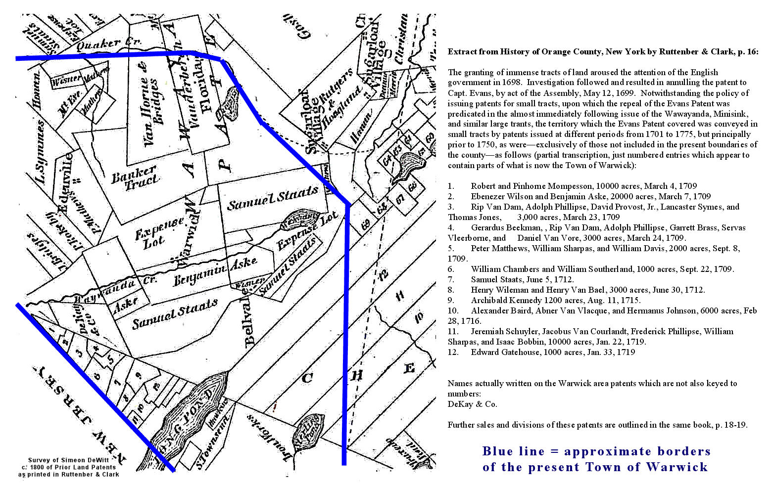
- Early
Land Patents as surveyed by Simeon Dewitt, from Ruttenber
and Clark’s History of Orange County
- Revolutionary
War Era
A section of "The provinces of New York and New Jersey; with part of Pensilvania, and the province of Quebec. Drawn by Major Holland,
Surveyor General, of the Northern District in America. Corrected and improved, from
the original materials, by Governr. Pownall, Member of Parliament, 1776. " from the Library
of Congress Collection
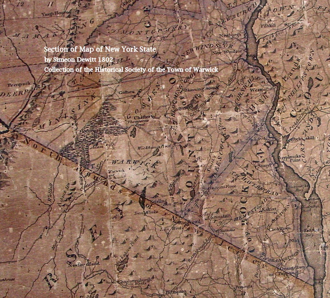
- 1802
Warwick Section from Map of New York State by Simeon Dewitt. We apologize
for the lack of clarity, as the original is damaged. We post it here for
the curious until a better original is scanned.
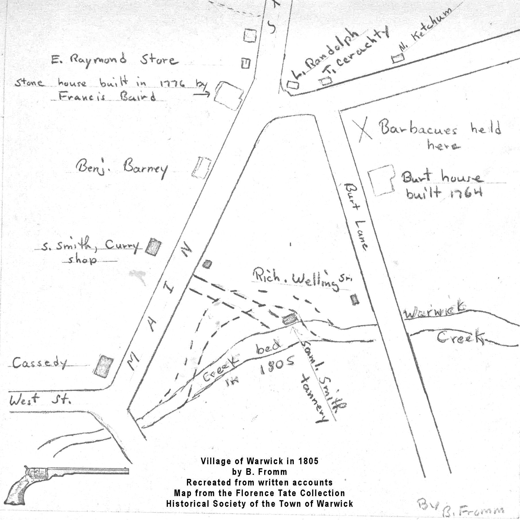
- 1805
Village of Warwick recreated from written accounts by B. Fromm.
From the Florence Tate Collection, Historical
Society of the Town of Warwick.
- 1805
Warwick Valley recreated from written account of Henry Pelton and others by Mrs. Elizabeth C. Van Duzer.
From the Warwick Historical Papers.
- 1829
Warwick Portion of Atlas of New York State by David H. Burr. Courtesy
of The
David Rumsey Collection.
- 1831 Geology Map
by Dr. James Young and Dr. J. Heron [Source: Collection of James Cline]
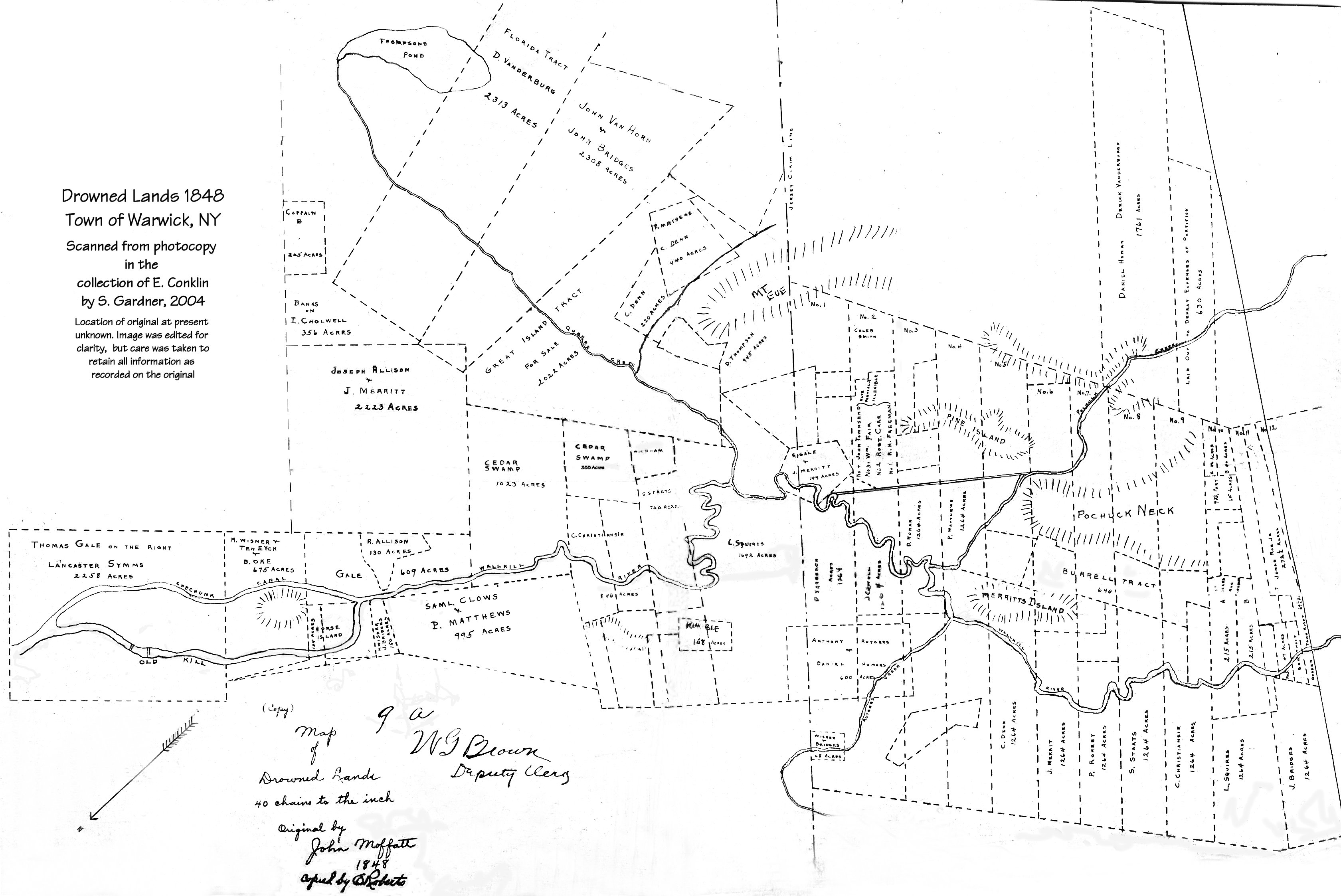
- 1848 Drowned
Lands: lots with owner names
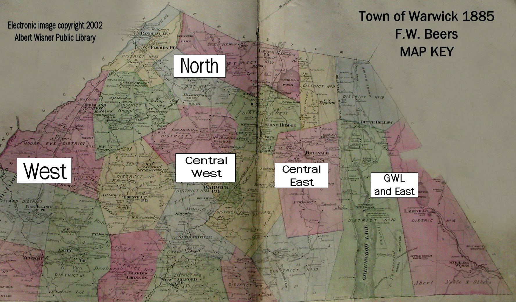
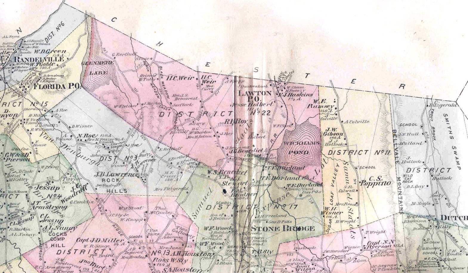
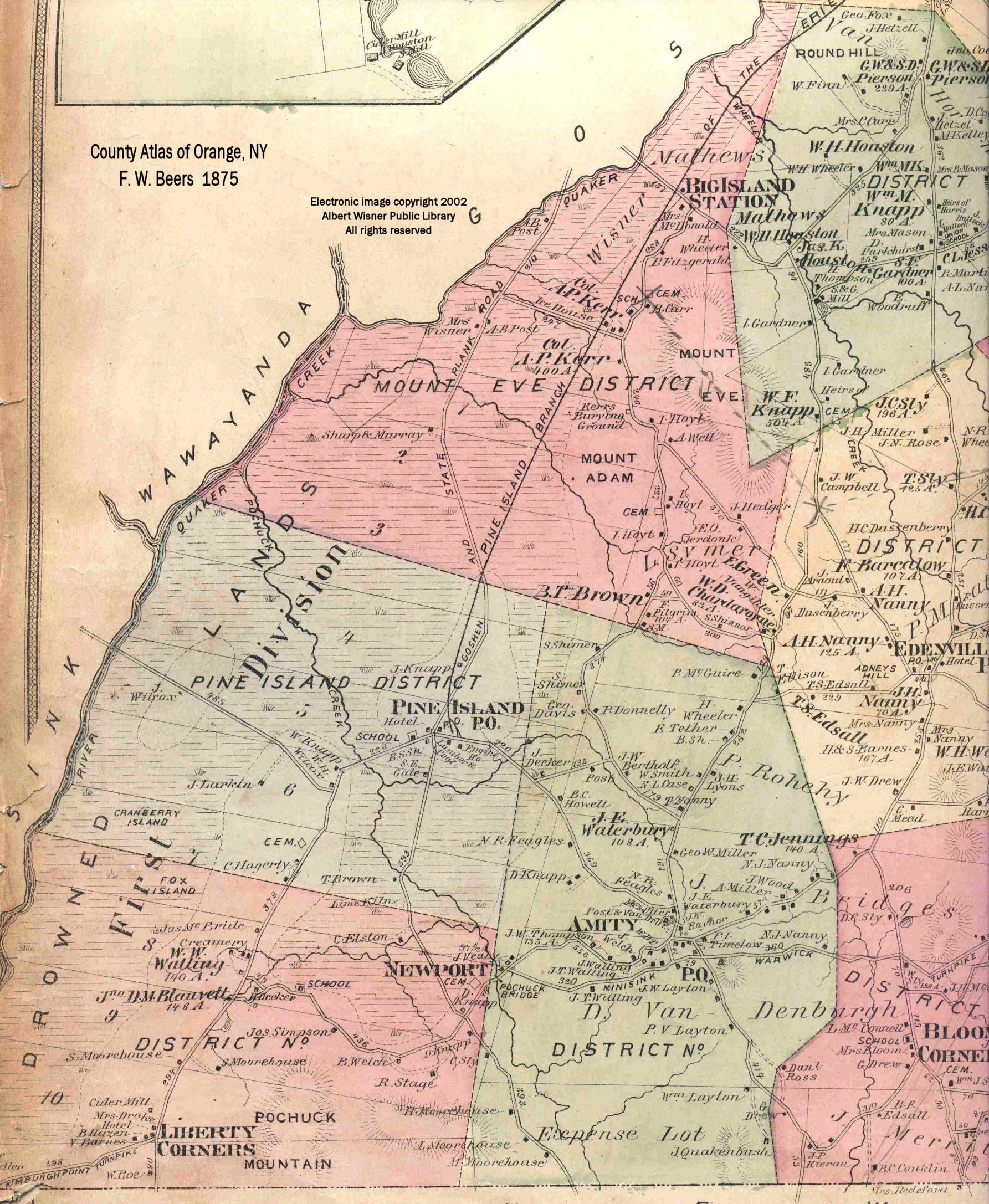
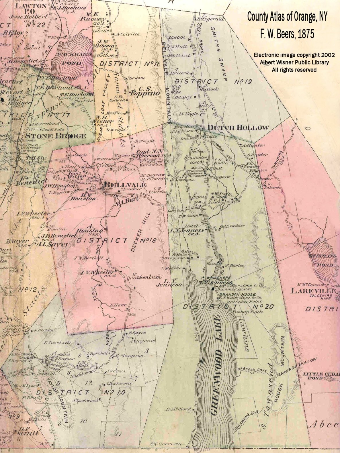
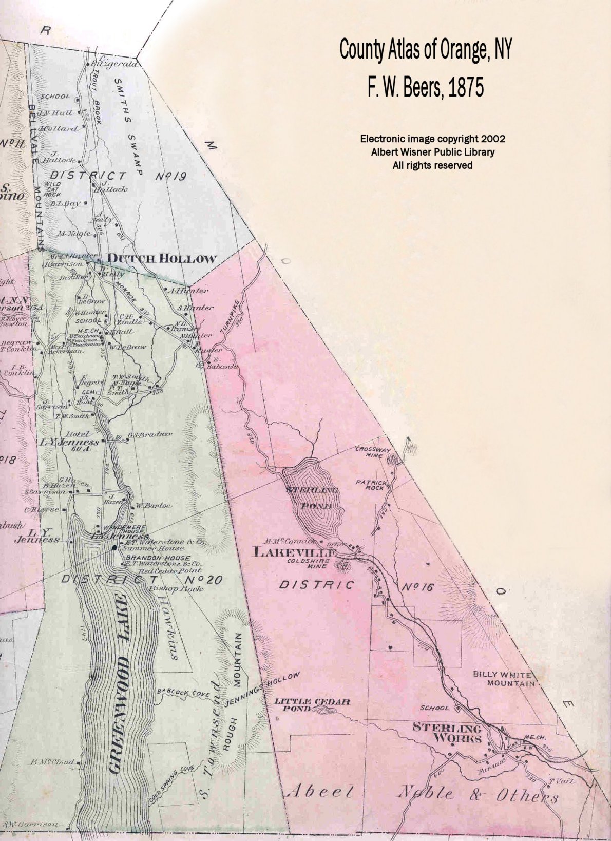
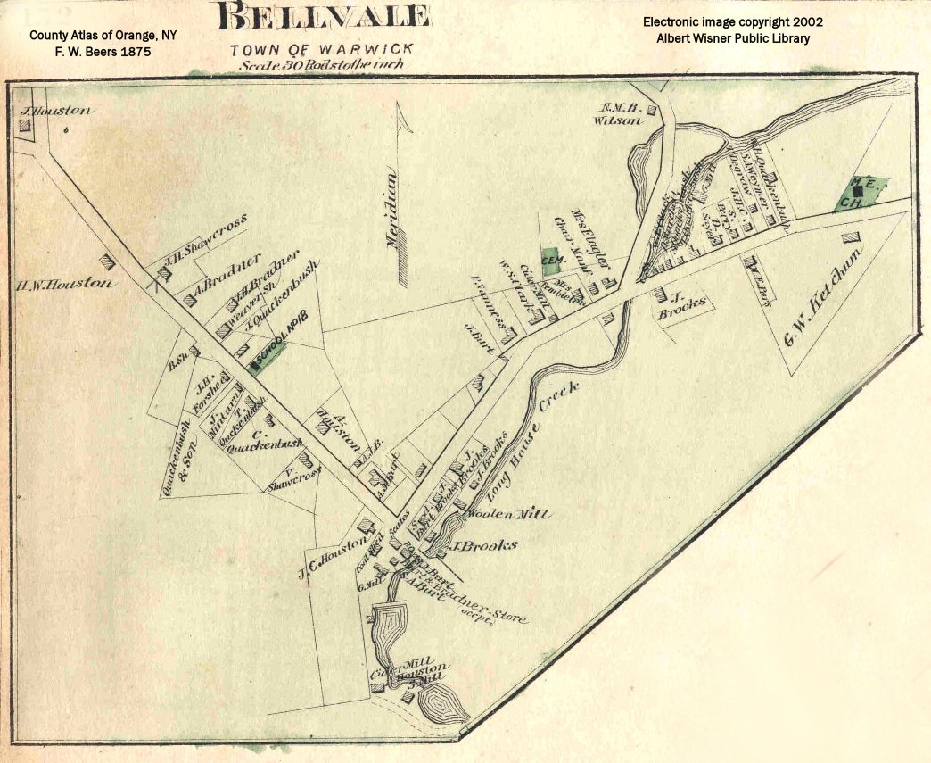
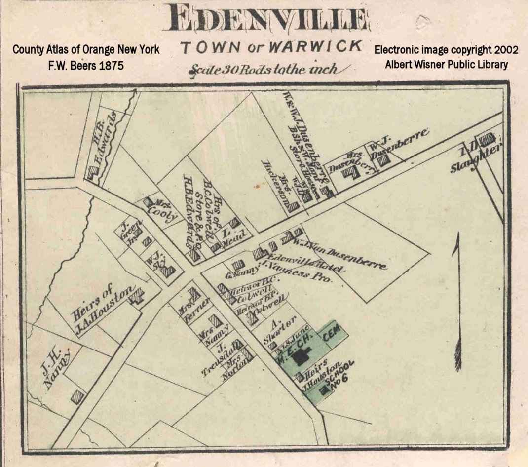
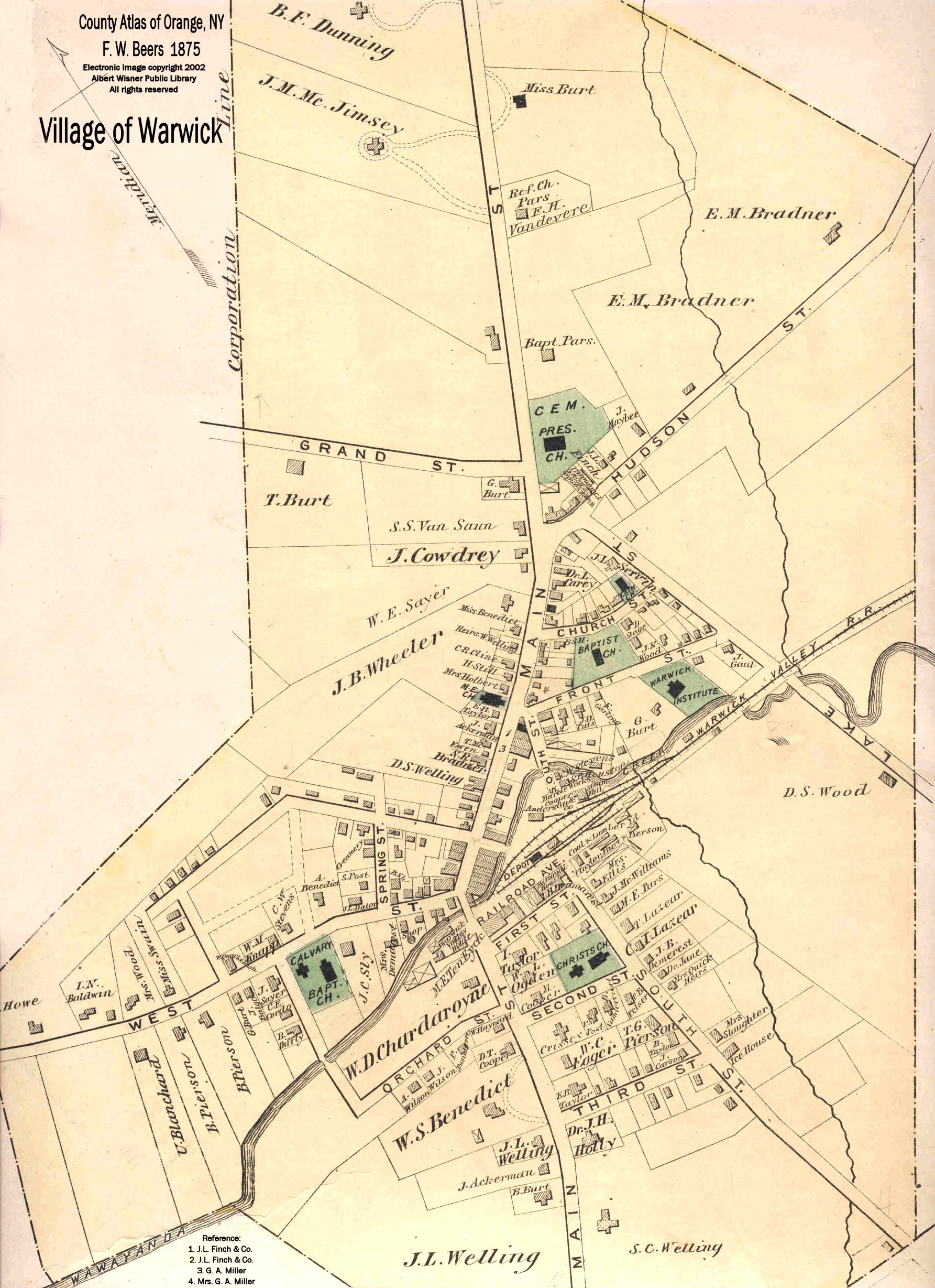
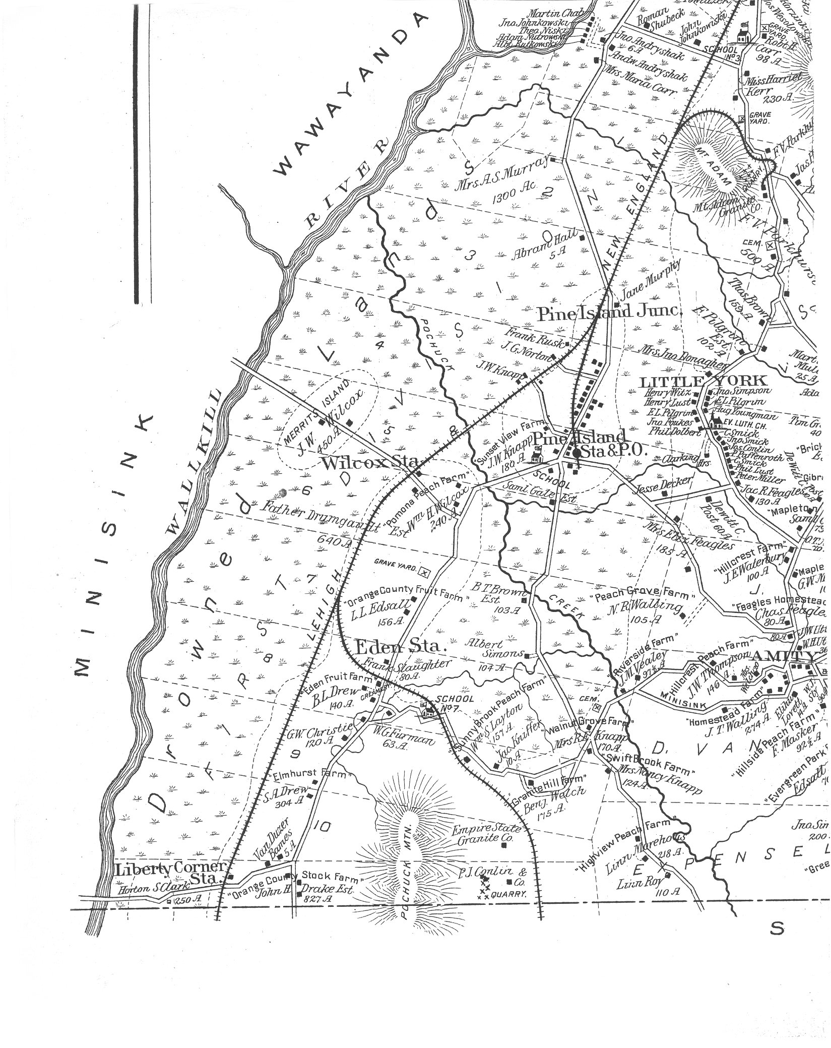
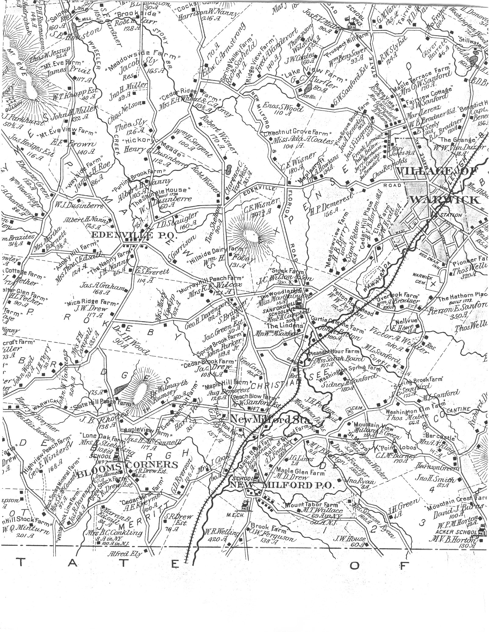
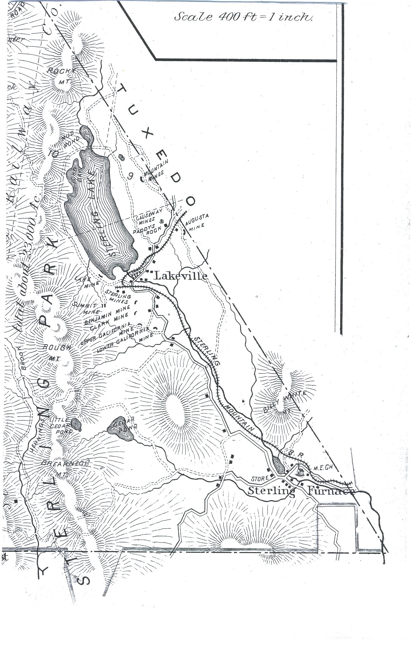
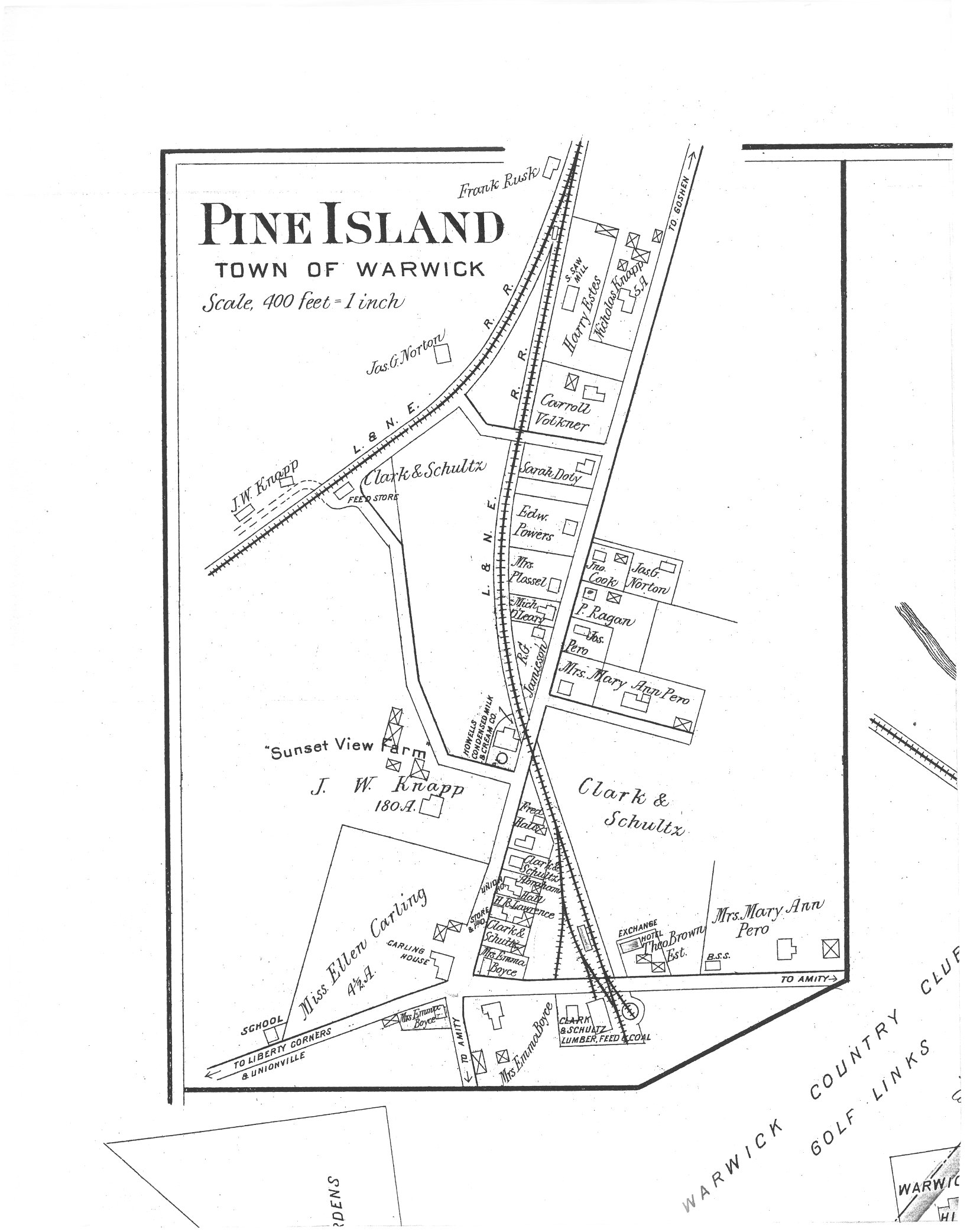
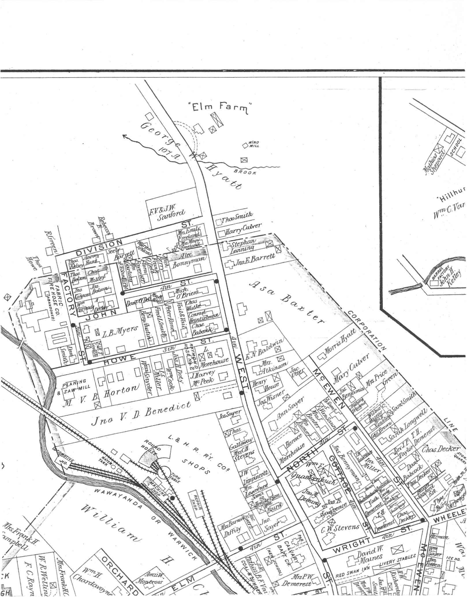
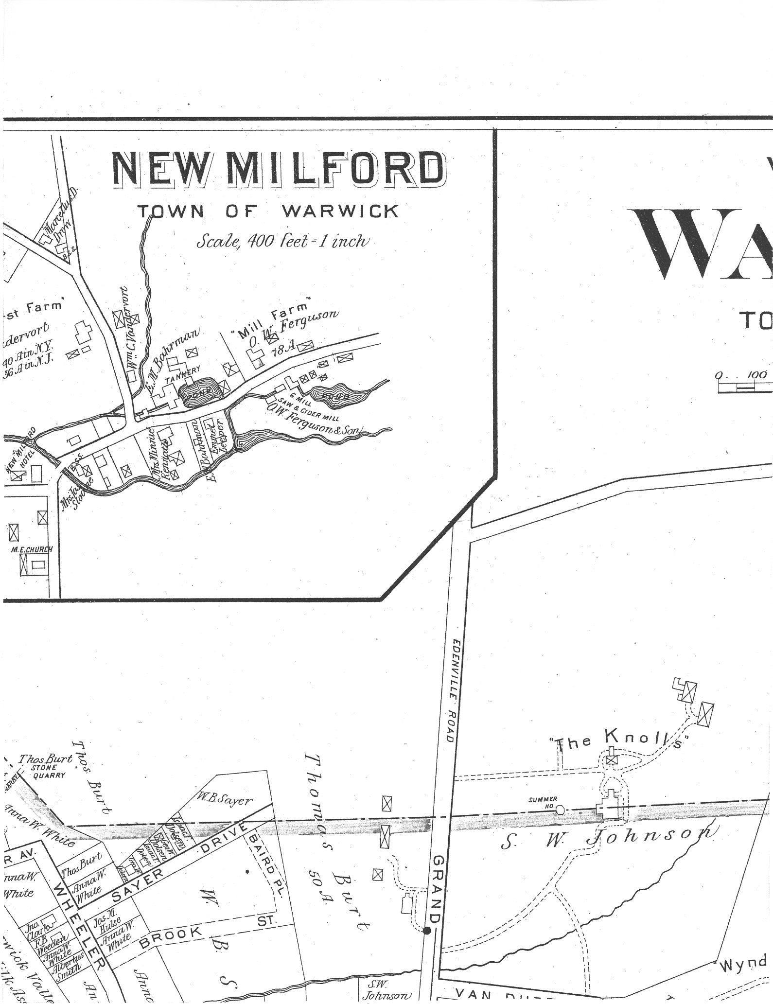
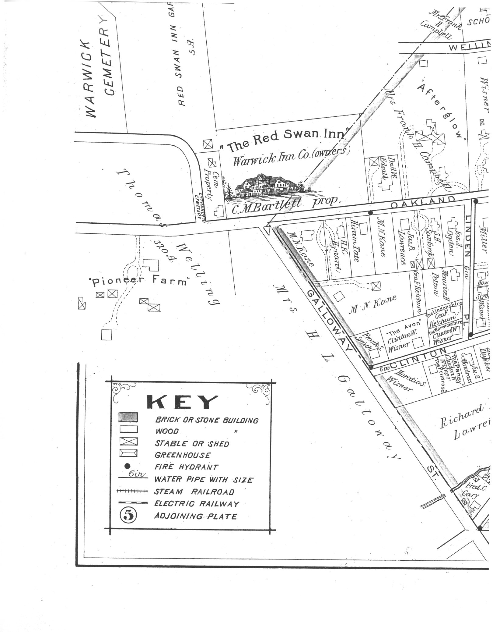
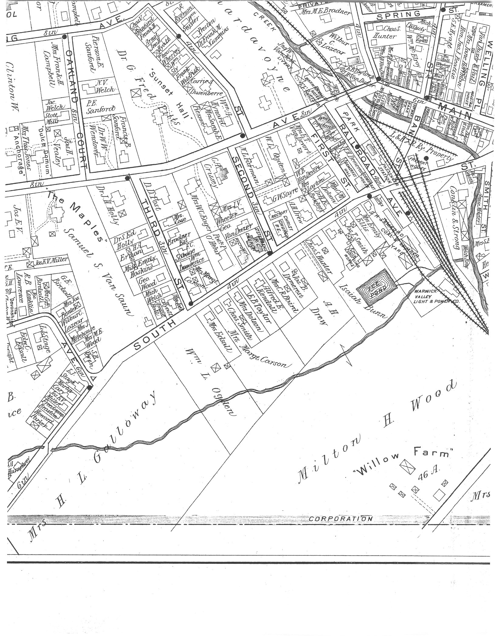
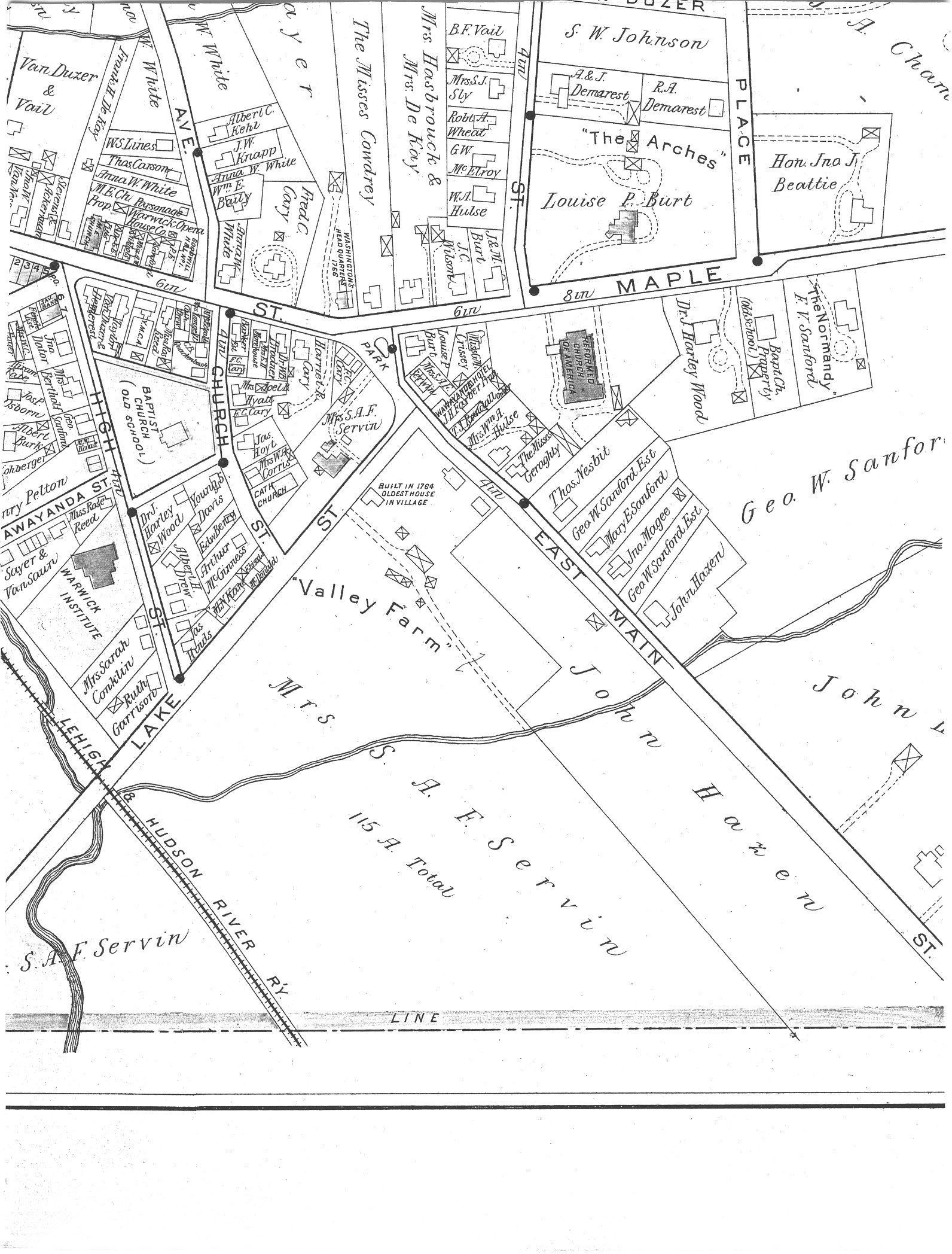
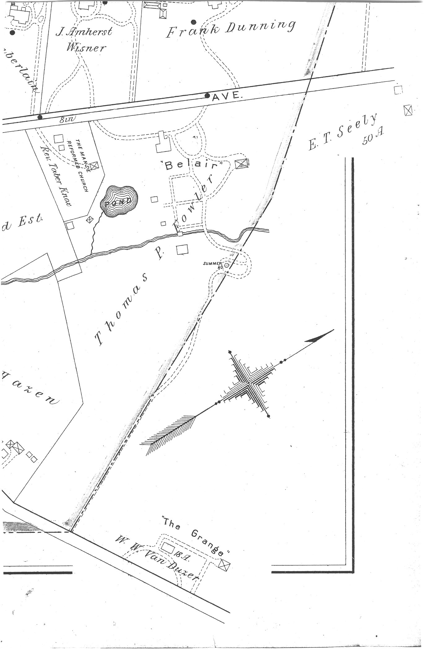
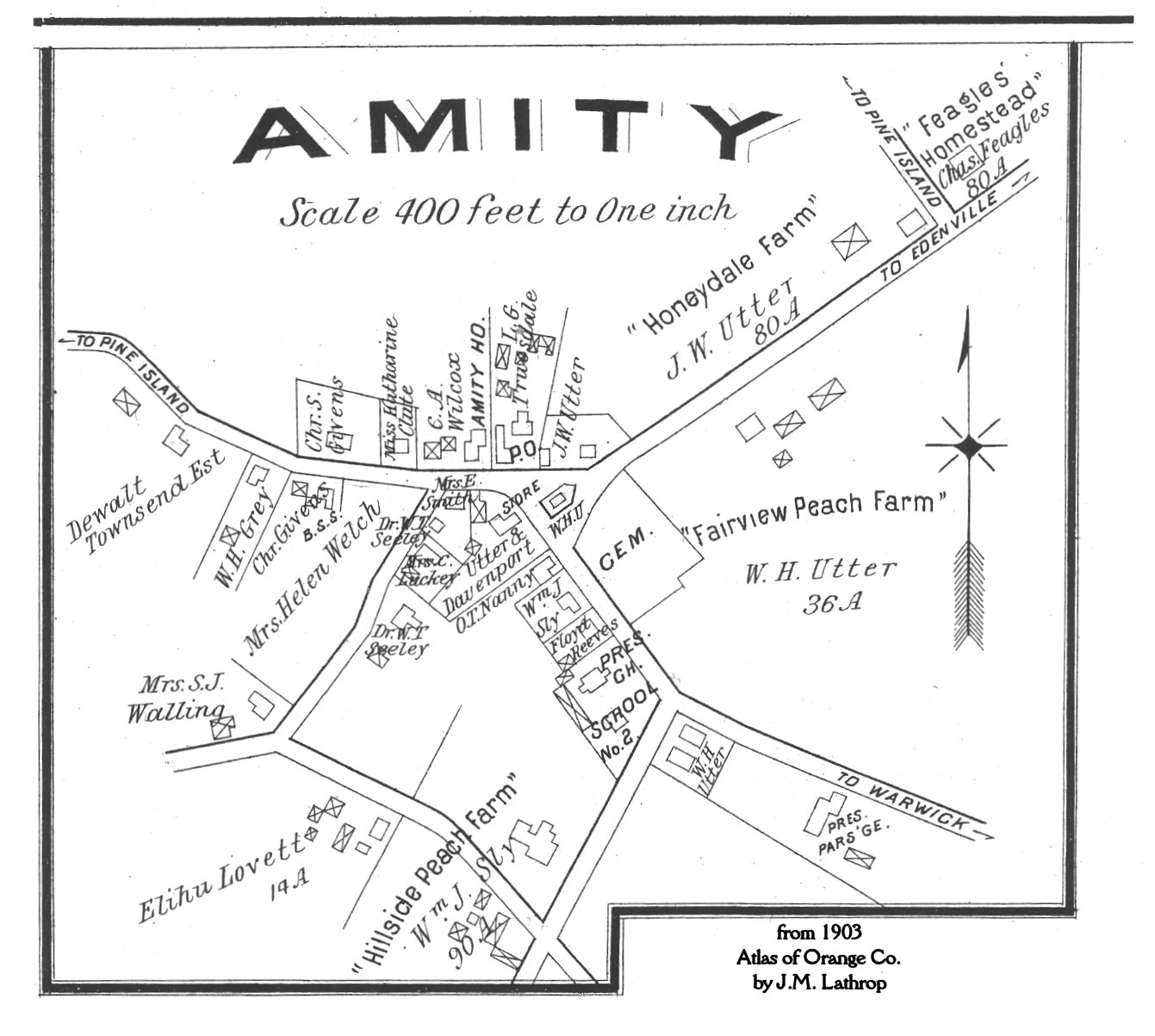
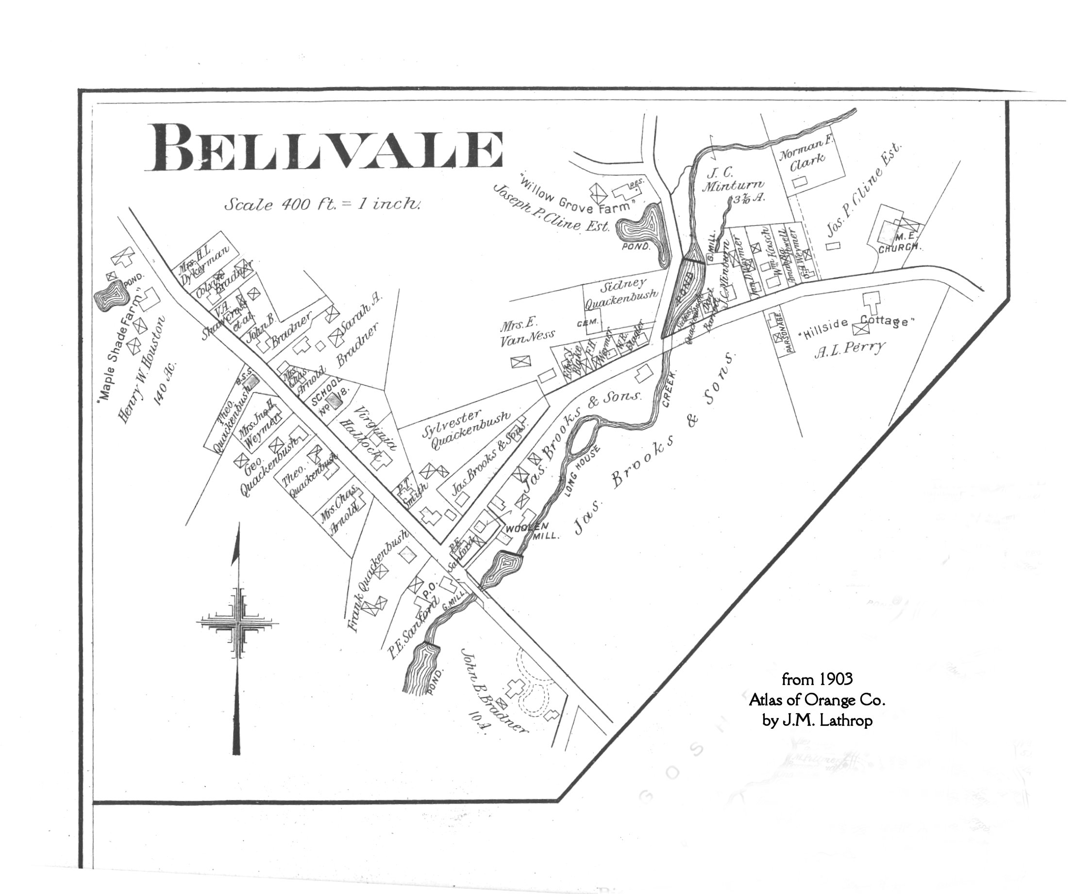
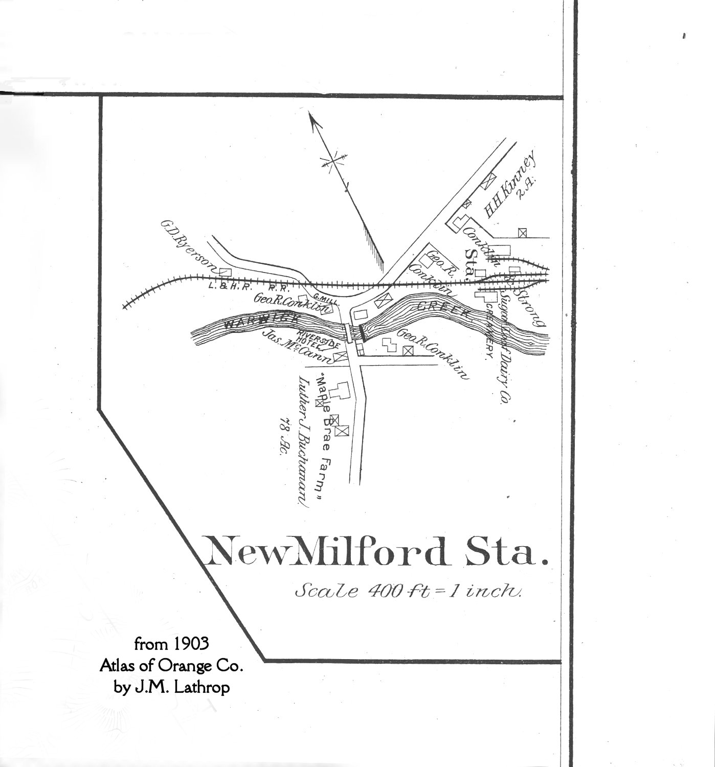
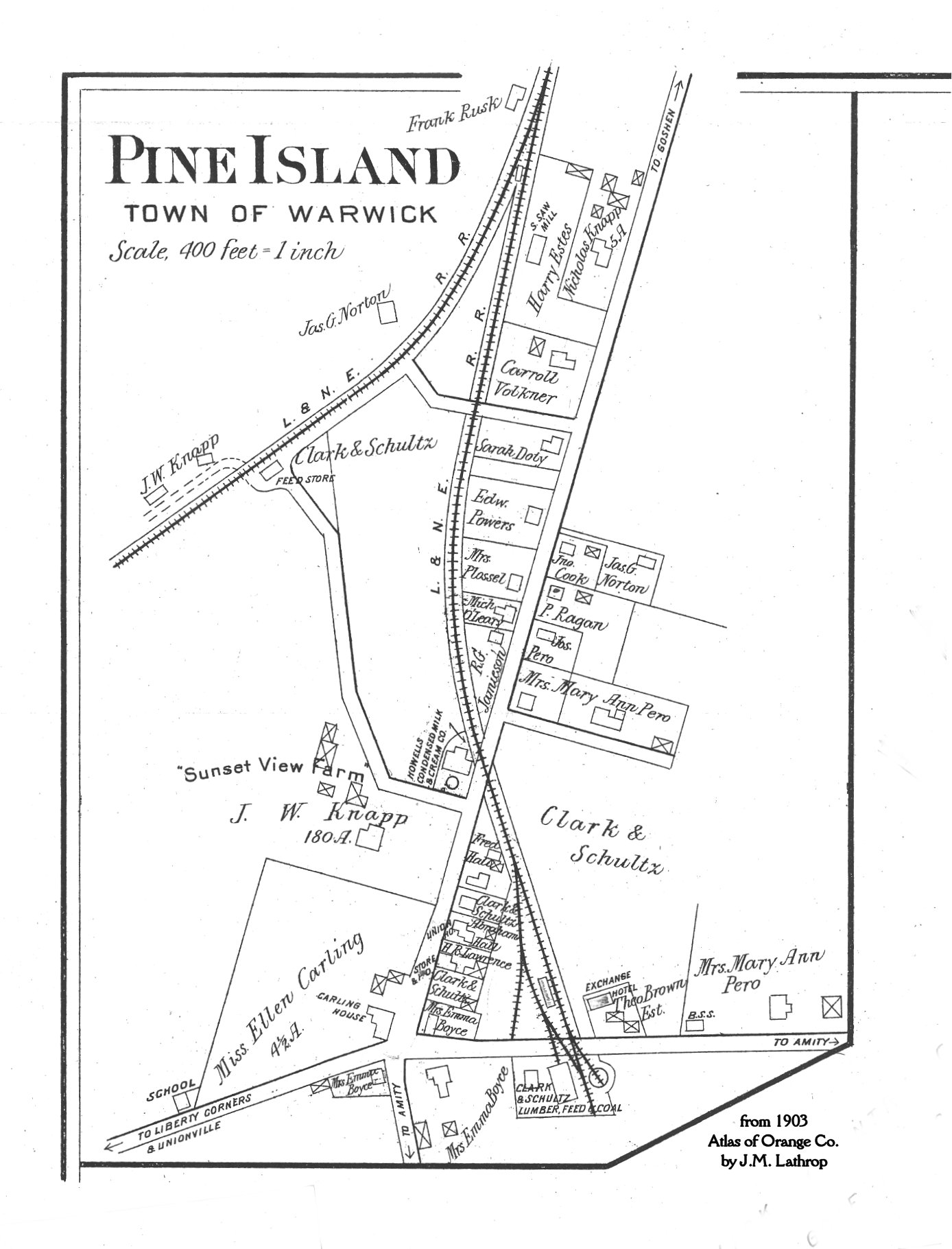
- County Atlas of Orange, NY -- 1875-- by F. W. Beers (Warwick Town & Villages)
Name
Index to the 1903 Village of Warwick Map (does not include Town)
|
1903 Atlas Map Sections: In order to provide a legible image
for these large maps, they been divided into sections. Consult the KEY map to
determine where the sections are. If you would like a closer view, return to
this page and click on it.
LOAD TIMES may be slow as the file sizes are large enough to give you an
image with readable text!
|
Current Maps
- Topographic Map
of the area. Point at various small points within "Orange
County", and the names of the local quadrangle will appear. Parts of
Warwick are on several, including Monroe and Pine Island.
- Sterling
Forest State Park
[Back to Warwick Valley History]