


Date
|
Description
|
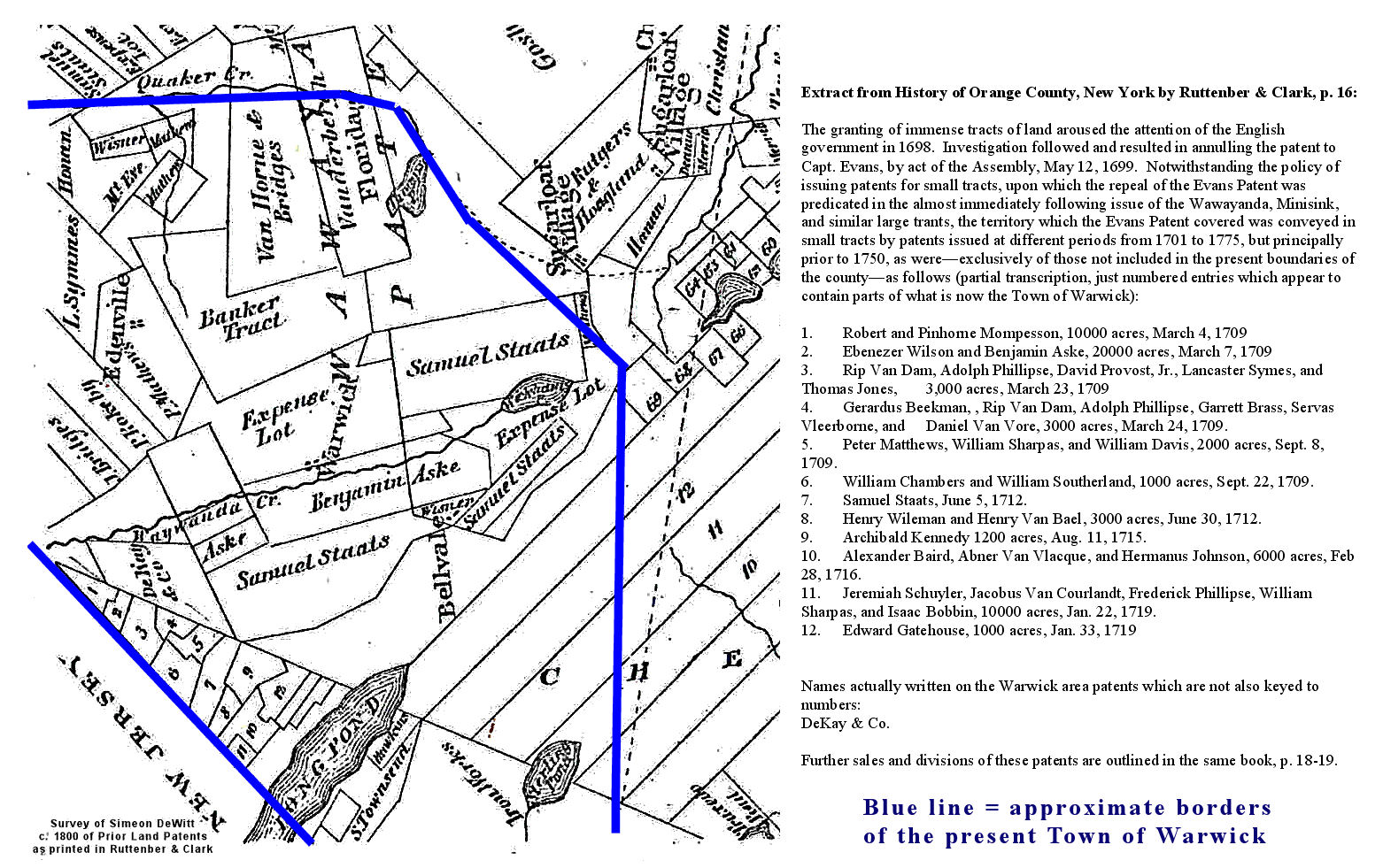
1700's
|
|
1700's
|
(from History of Orange County by Ruttenber & Clark)\
|
1776
|
A section of "The provinces of New York and New Jersey; with part of Pensilvania, and the province of Quebec. Drawn by Major Holland, Surveyor General, of the Northern District in America. Corrected and improved, from the original materials, by Governr. Pownall, Member of Parliament, 1776. " from the Library of Congress Collection
|
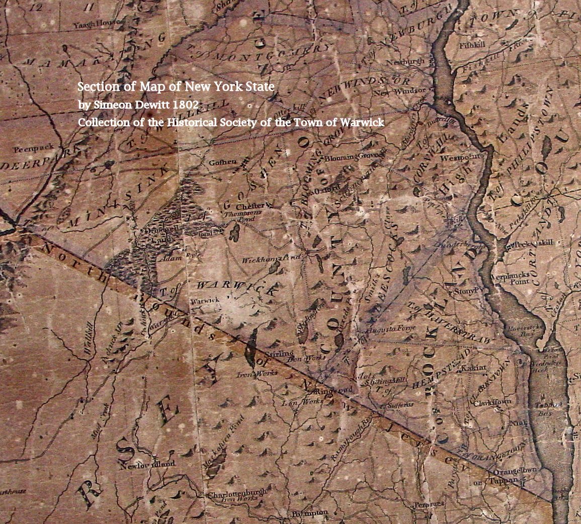
1802
|
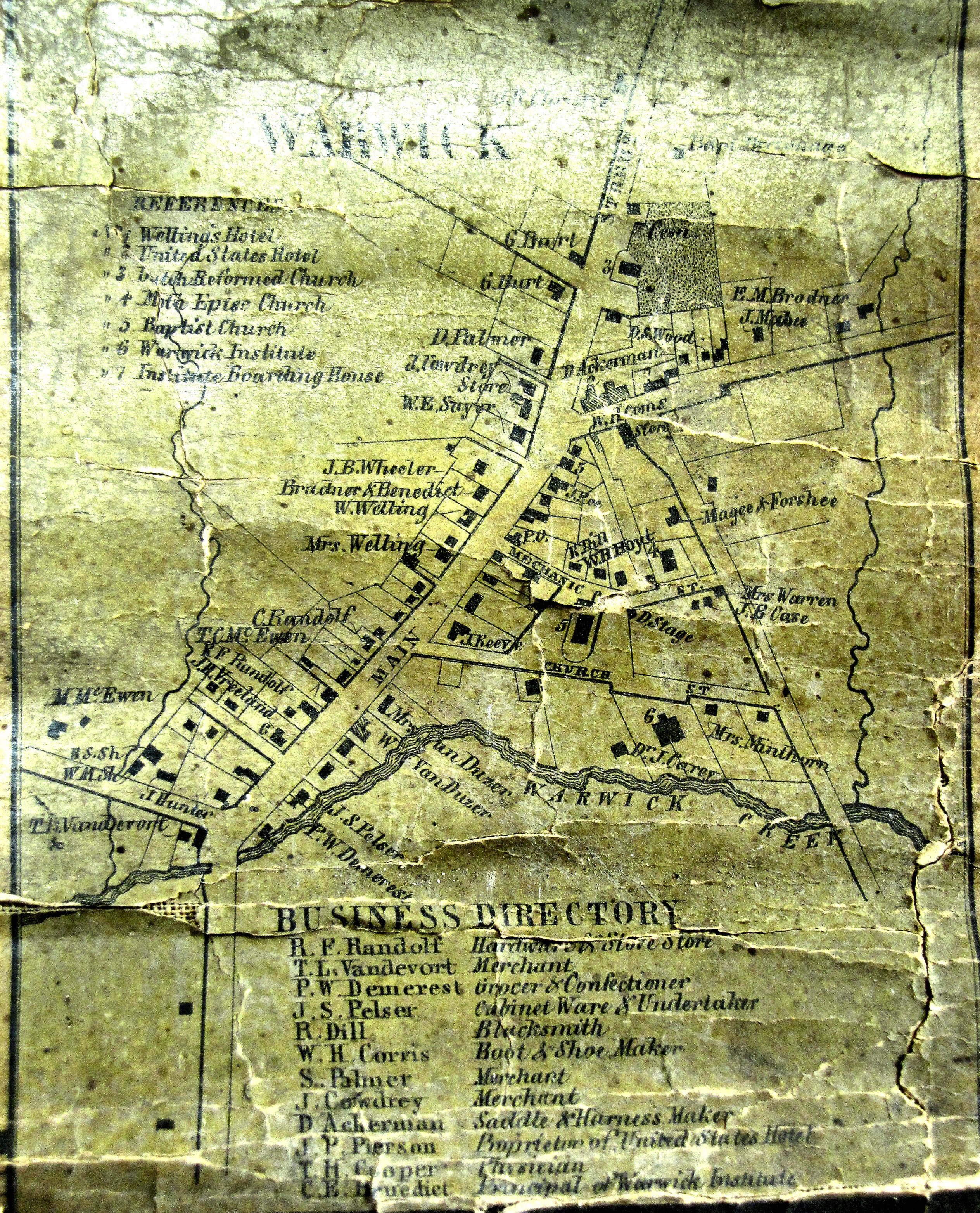
We apologize for the lack of clarity, map is damaged.
|
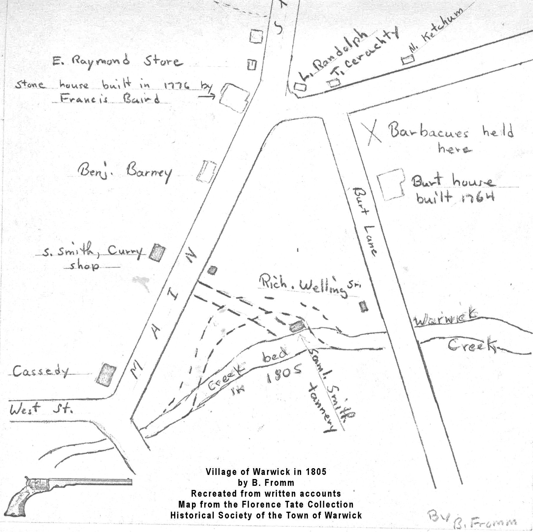
1805
|
Recreated from the memoirs of Henry Pelton by B. Fromm
|
1805
|
Recreated from the memoirs of Henry Pelton by Elizabeth C. Van Duzer
|
1829
|
Courtesy of the David Rumsey Collection
|
1831
|
by Dr. James Young and Dr. J. Heron (published as part of a reference work on geology of New York State).
|
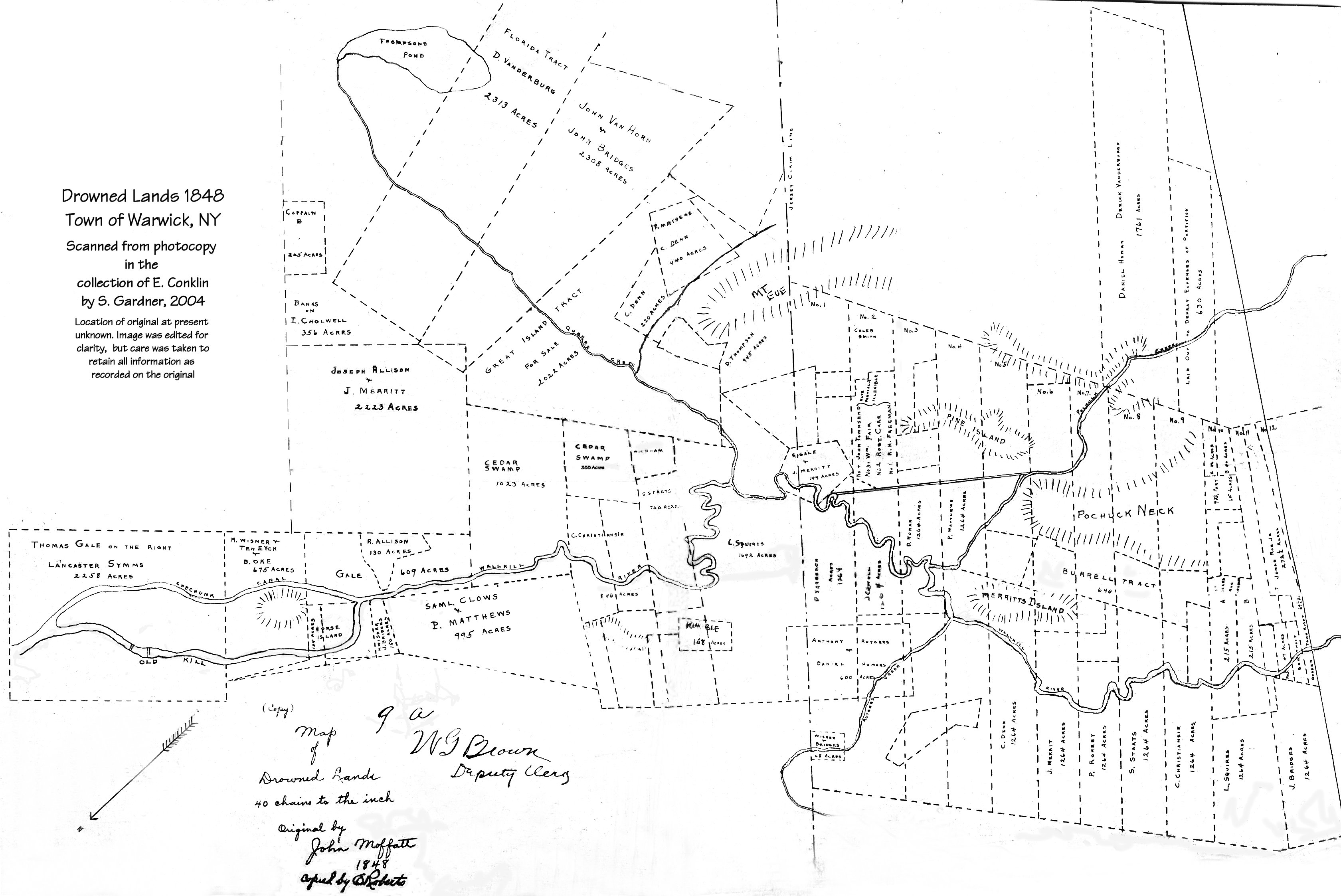
1848
|
|
1850
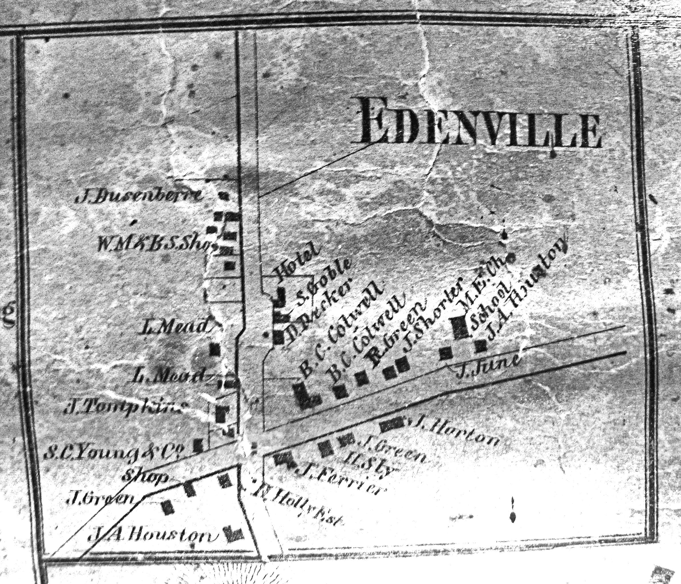
|
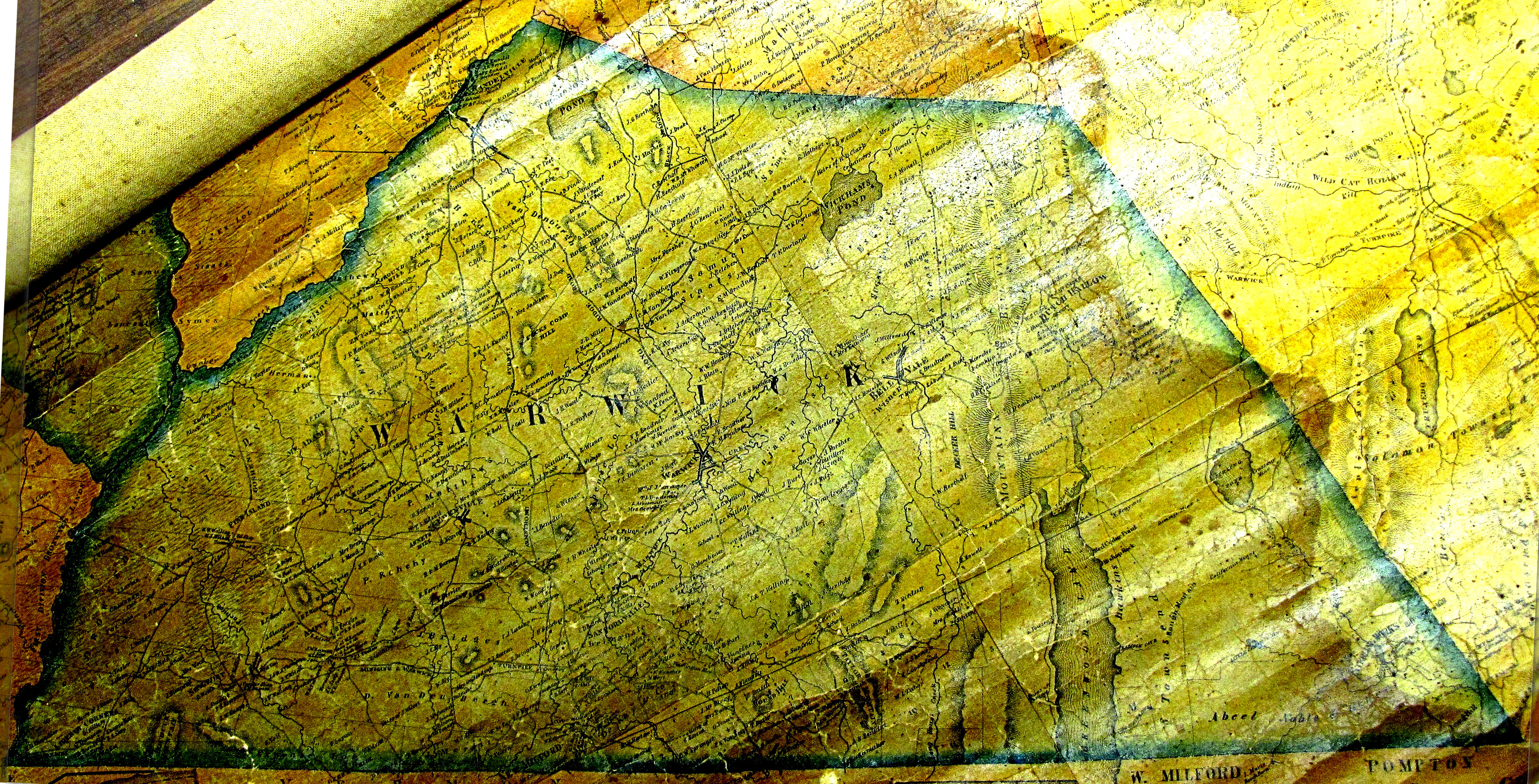
Town of Warwick with property owner names by J. C. Sidney
Copies available from the Orange County Genealogical Society
|
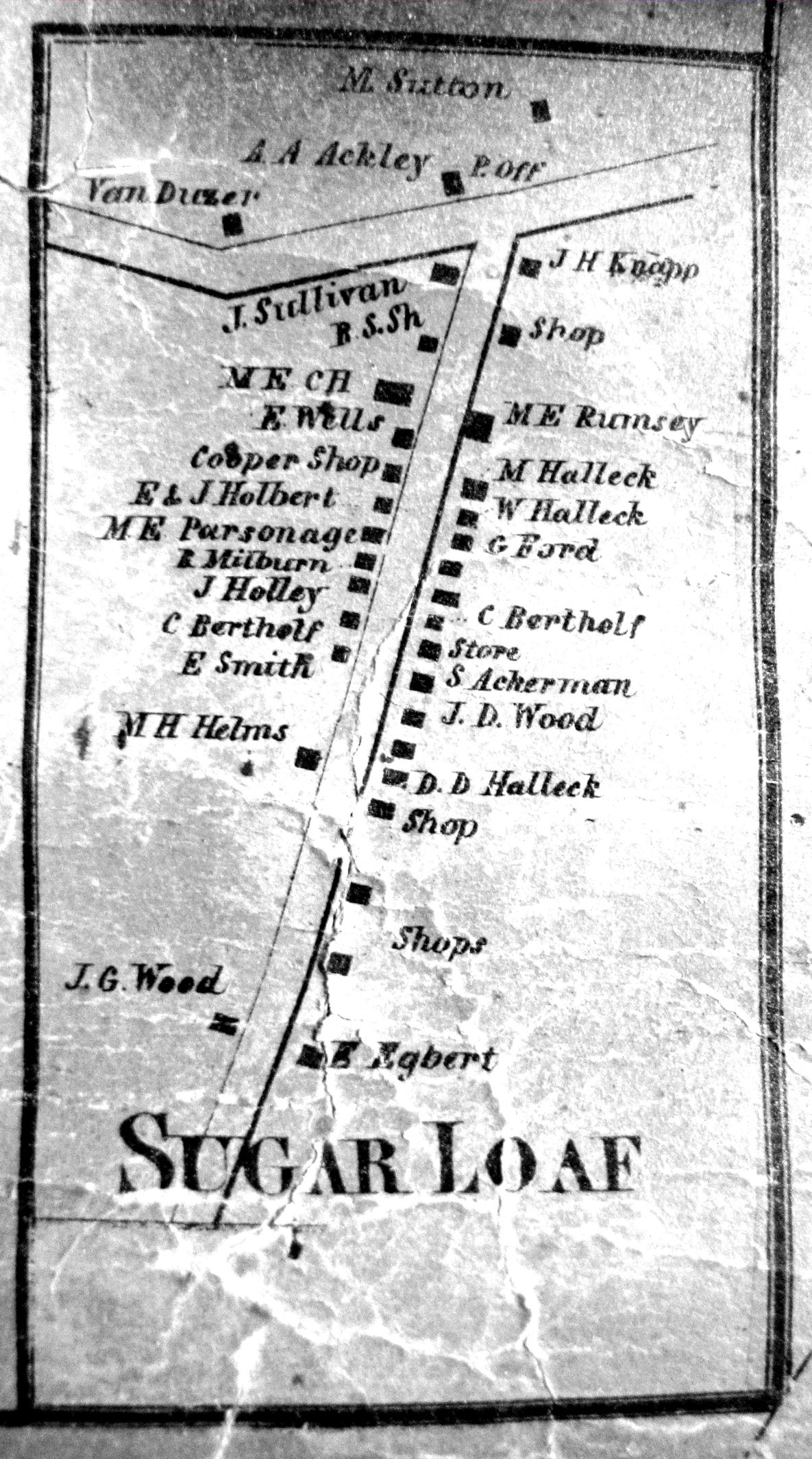
1850
|
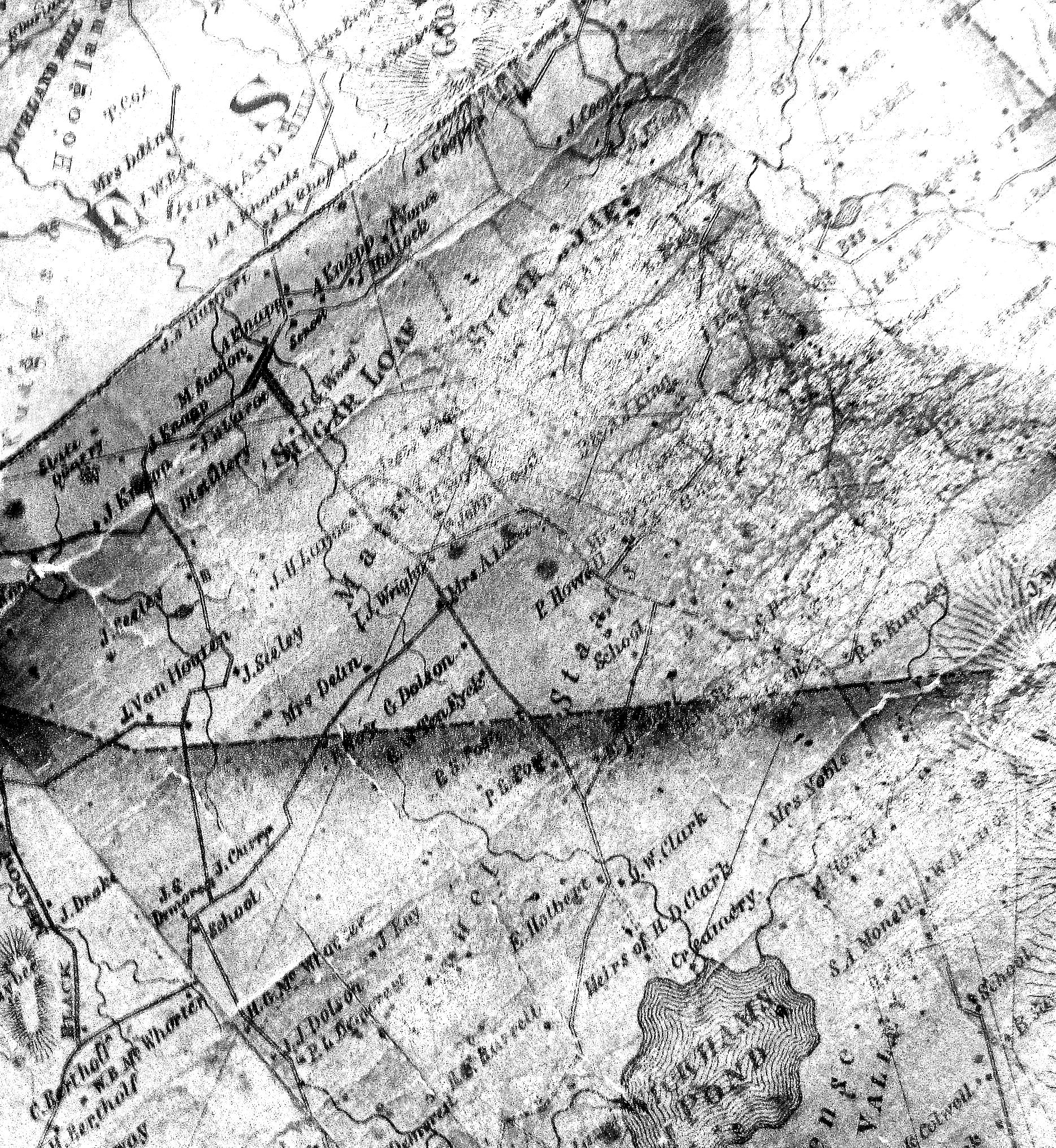
Sugar Loaf Valley from the Sugar Loaf Historical Society website, J. C. Sidney map
|
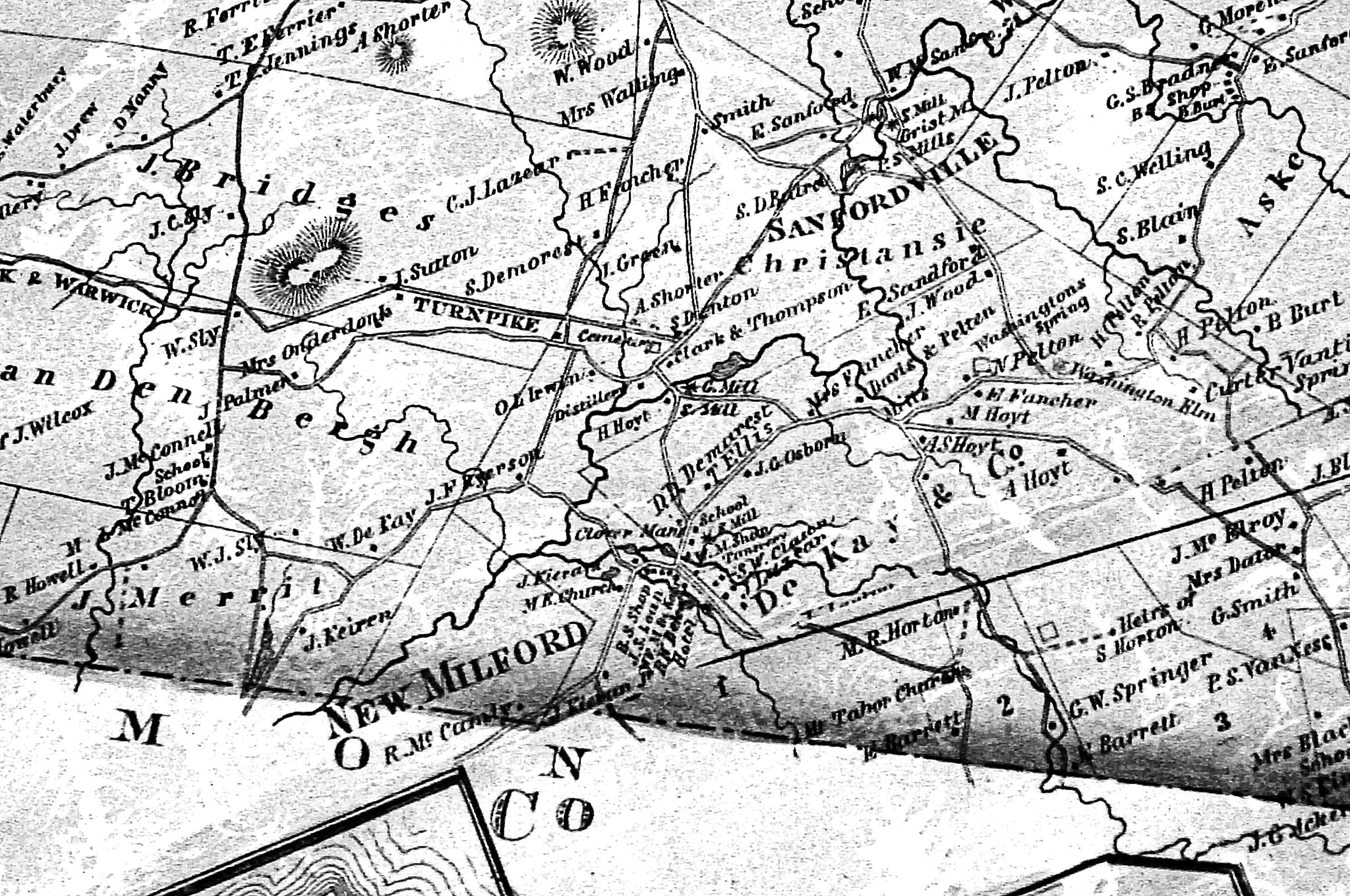
1859
|
Town of Warwick & Sugar Loaf from Map of Orange & Rockland Counties
Hamlet & Village areas:
o Greenwood Lake/Dutch Hollow
o Bellvale
|
1863
|
|
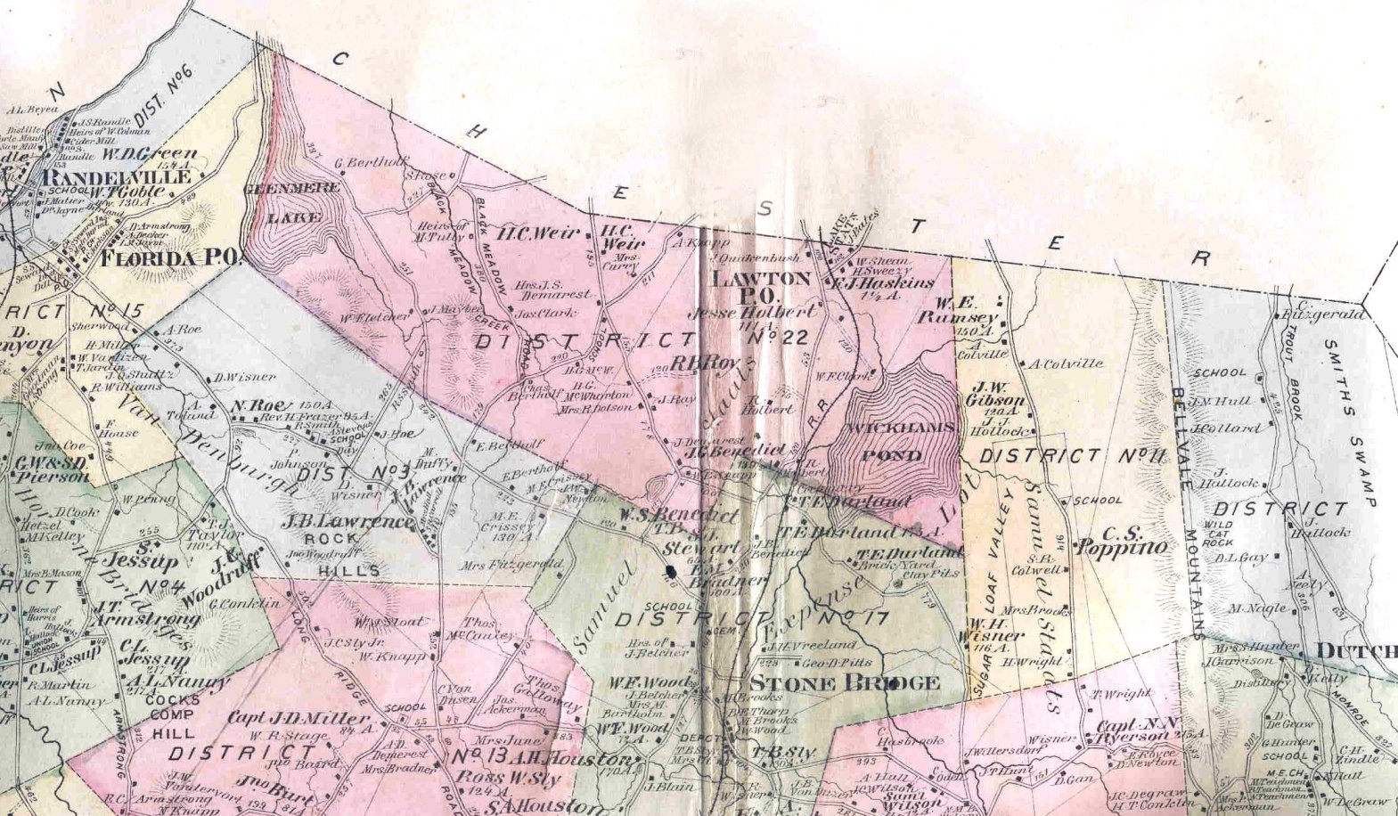
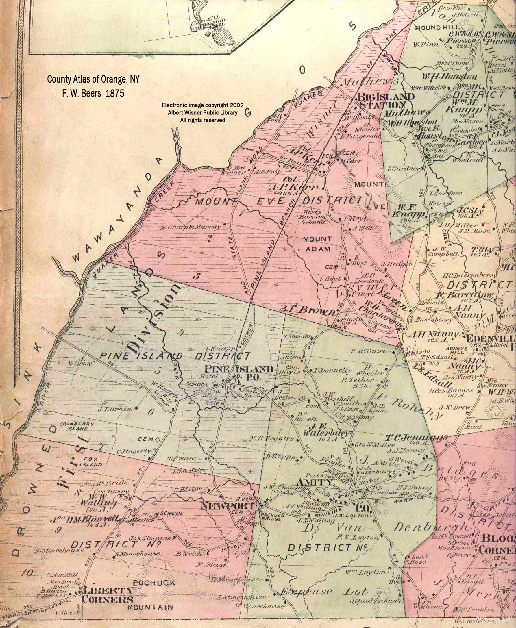
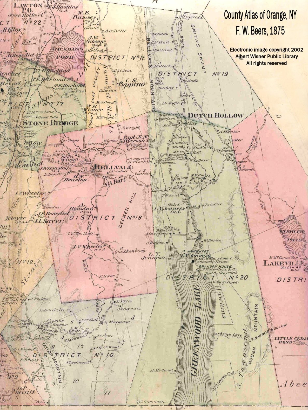
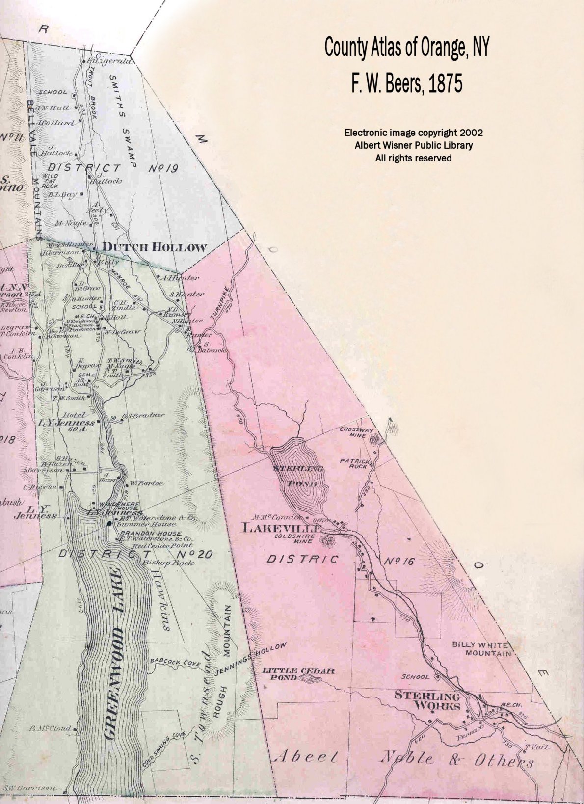
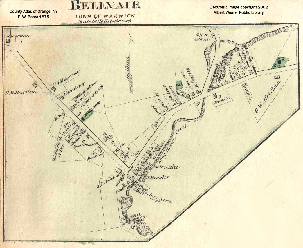
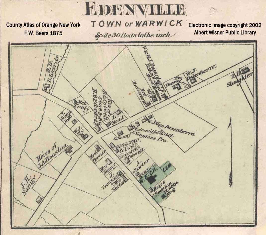
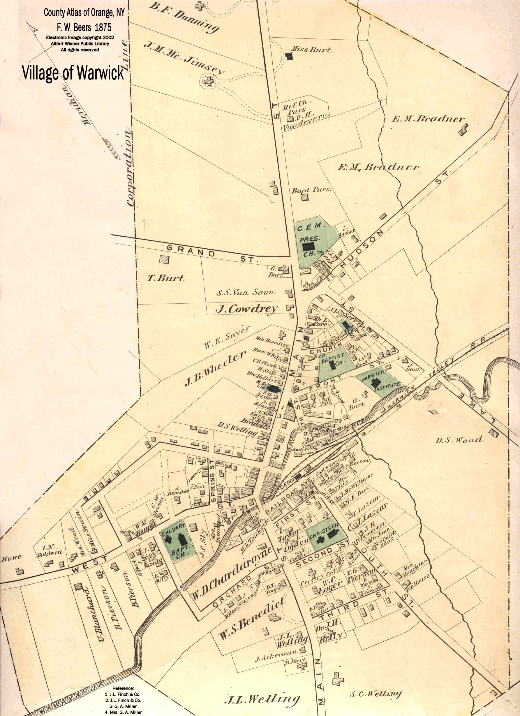
1875
|
|
1881
|
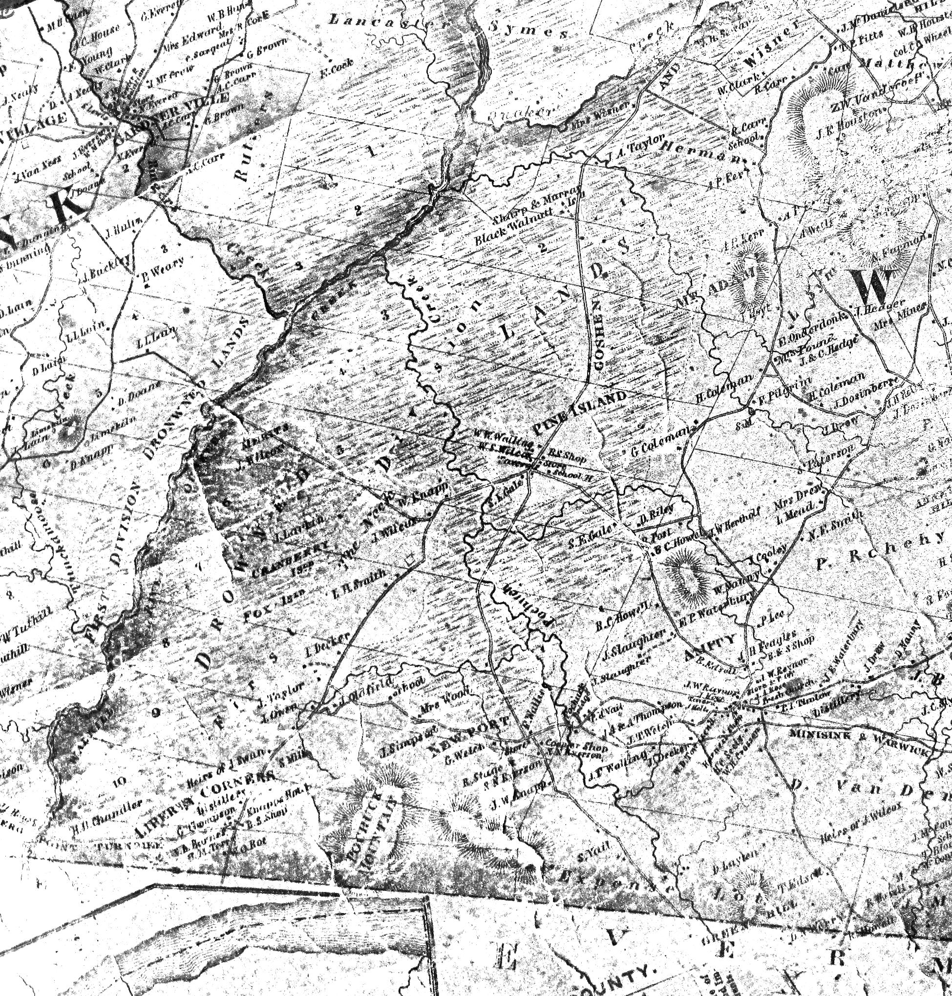
Drowned Lands of the Wallkill
Prior to drainage, as shown in "History of Sussex & Warren Counties" by James P. Snell
|
1887
|
Birds' Eye View of the Village of Warwick
from the Library of Congress Website
|
1888
|
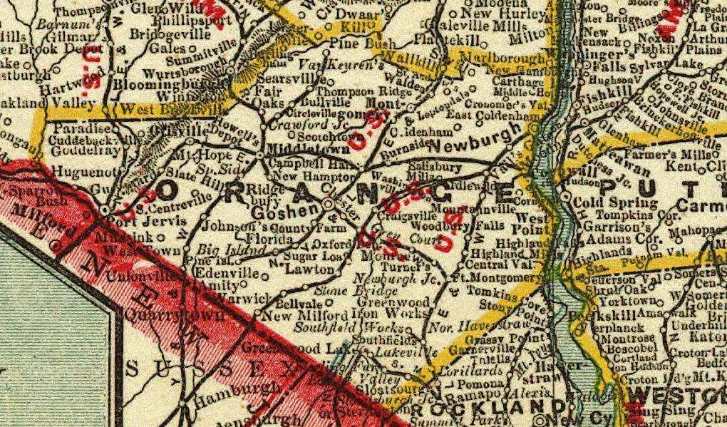
a section of "Cram's township and rail road map of New York" from the Library of Congress Website
|
1893 - 1935
|
Topographic Maps of the area from the U.S. Geological Survey
The Town of Warwick is split between the Greenwood Lake & Goshen quadrangles.
|
1895
|
Main St. Warwick as recalled by Mrs. Frank Holmes
From the Warwick Advertiser 08/08/1967
|
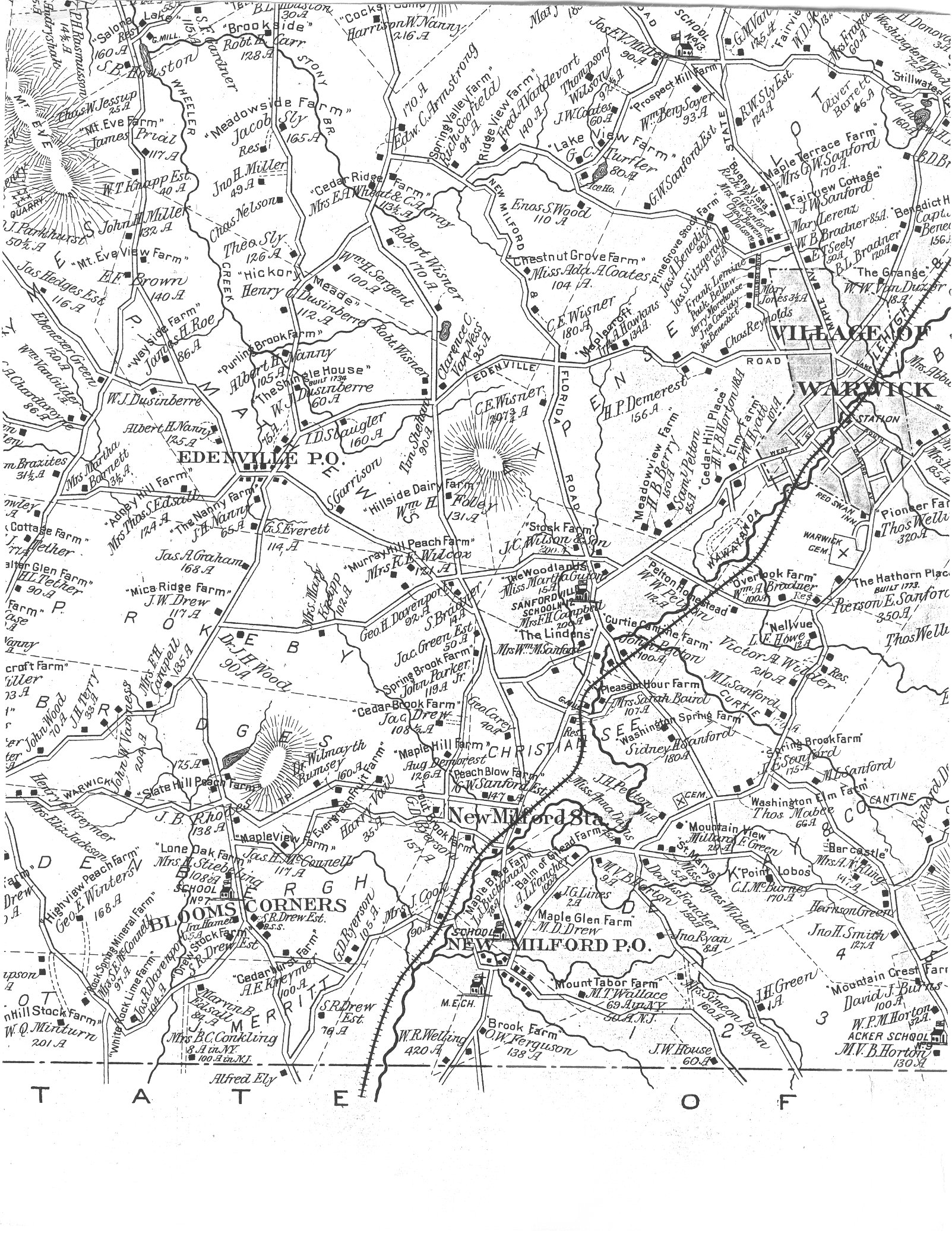
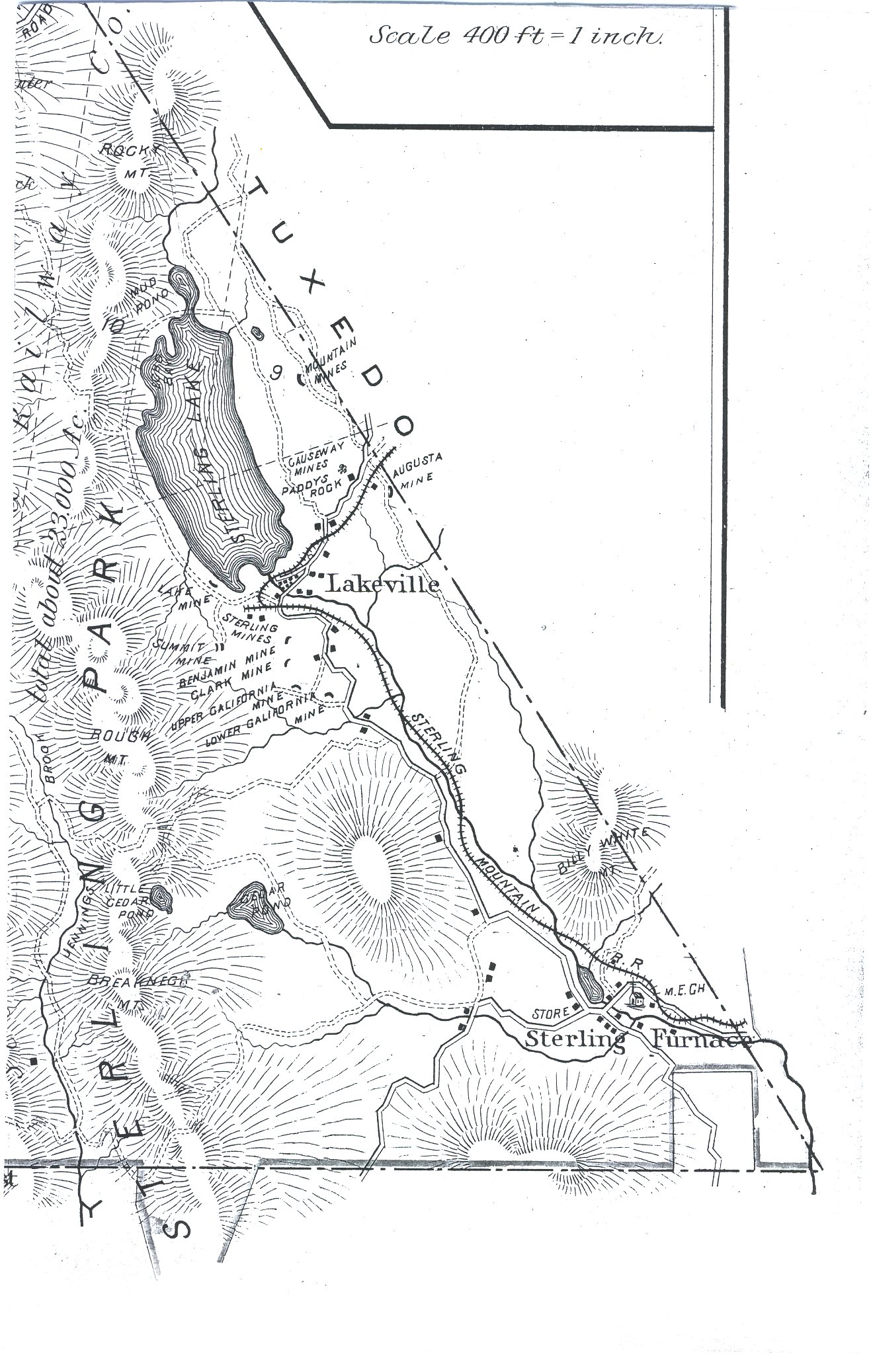
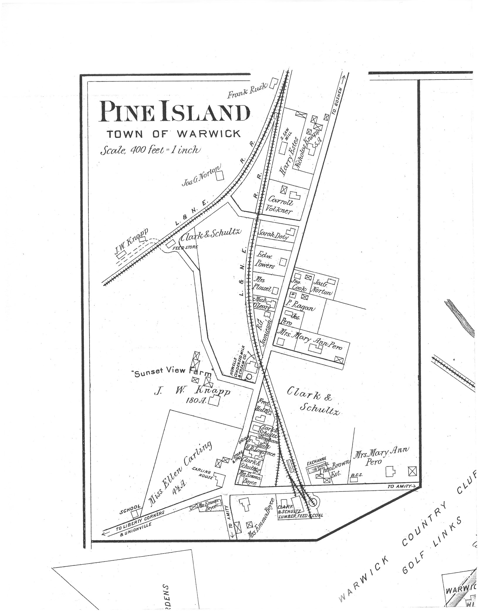
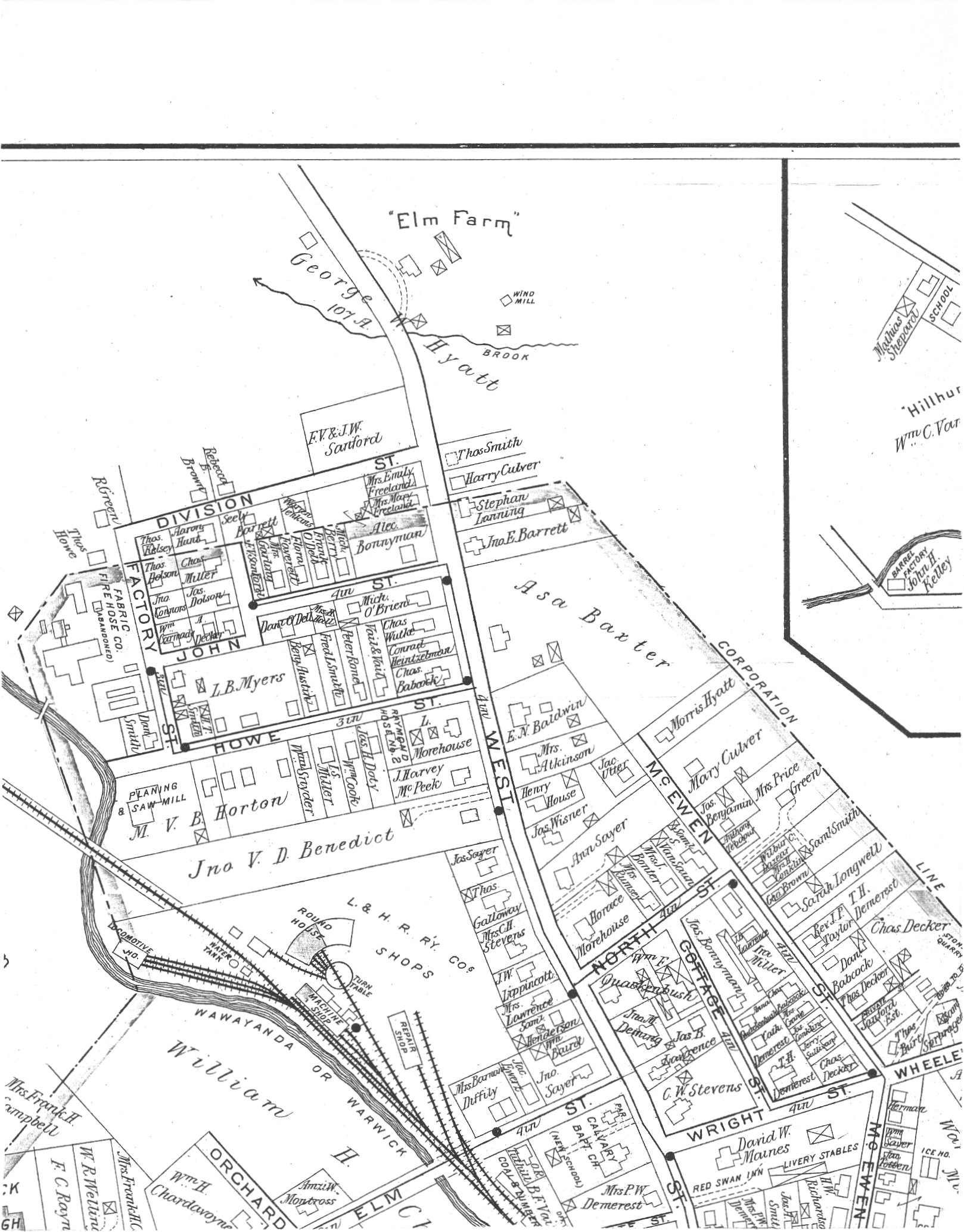
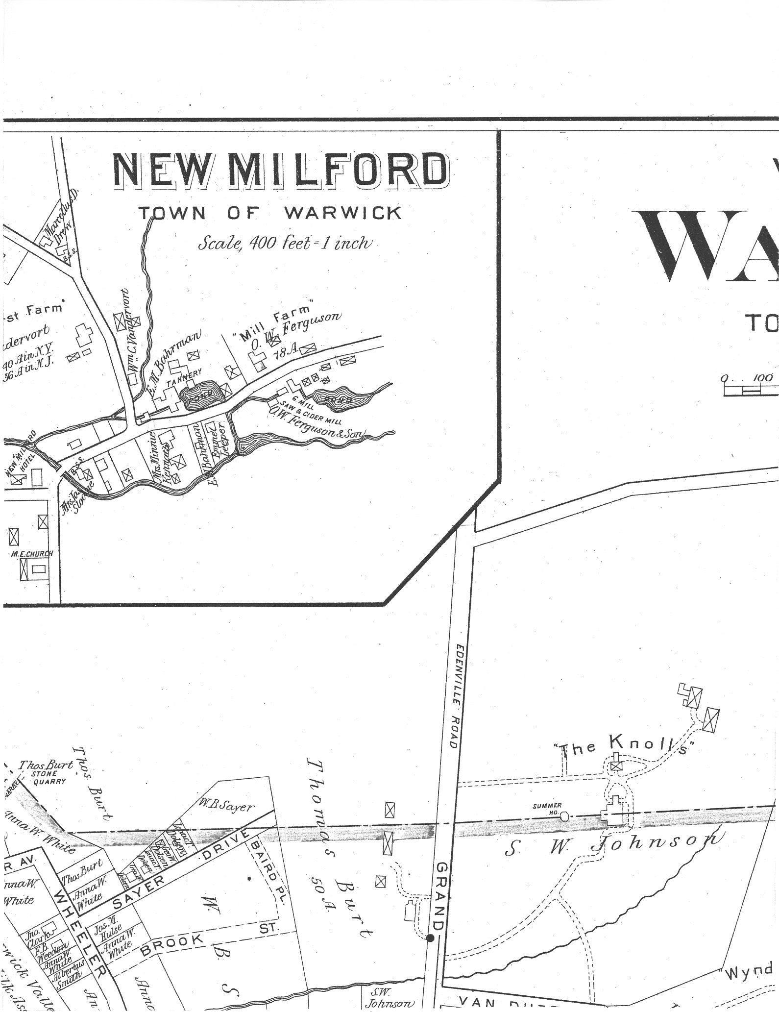
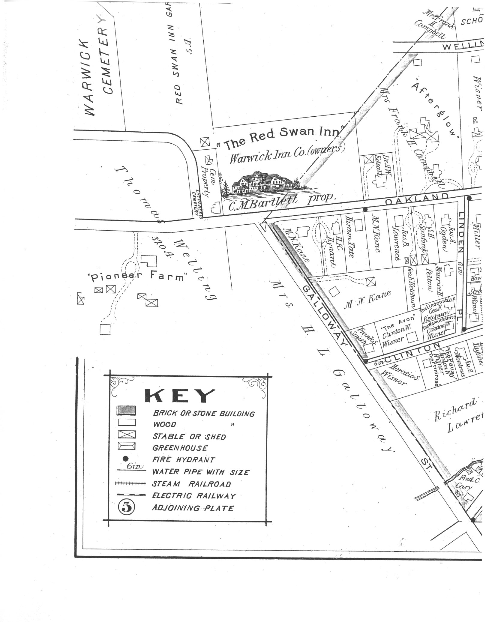
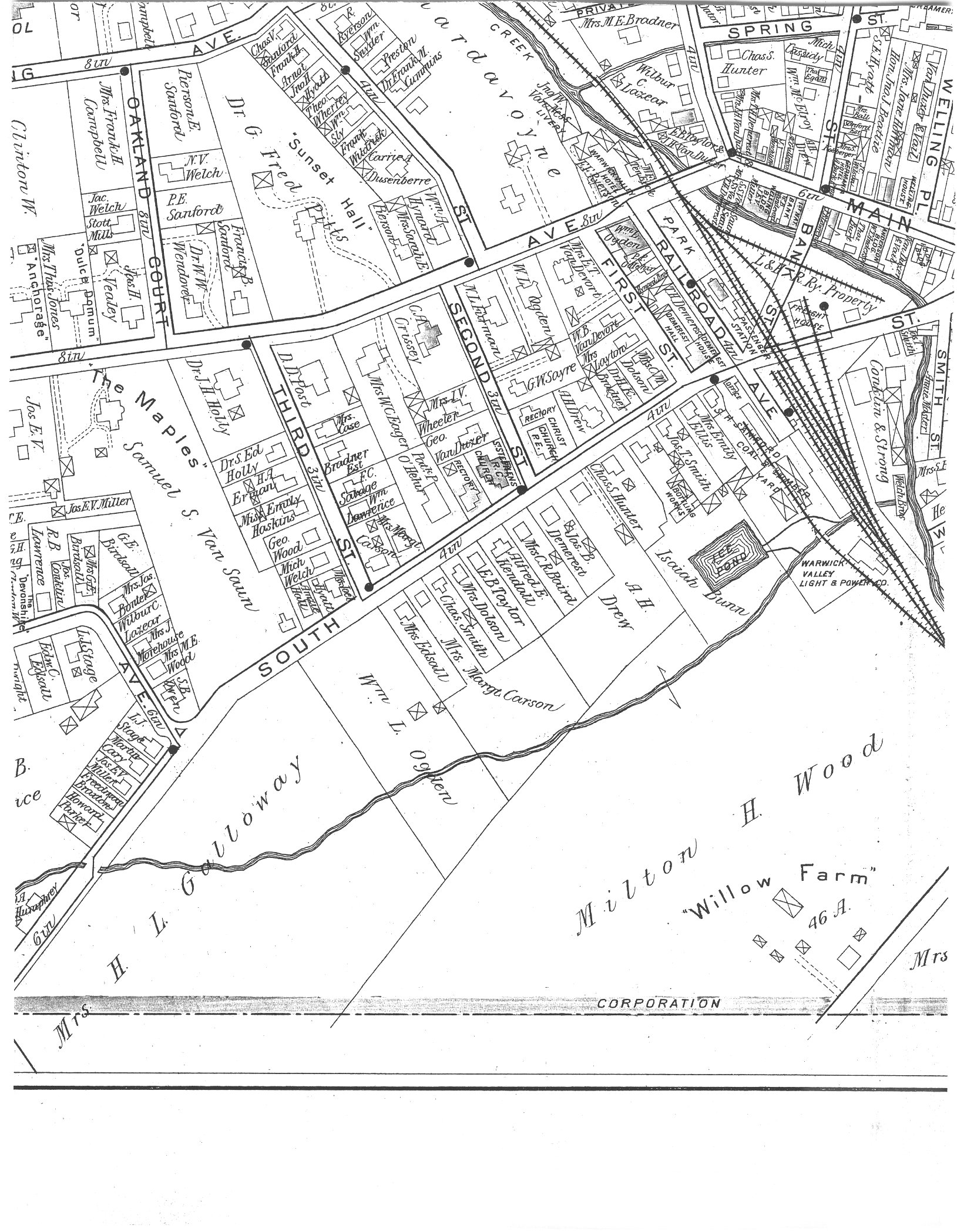
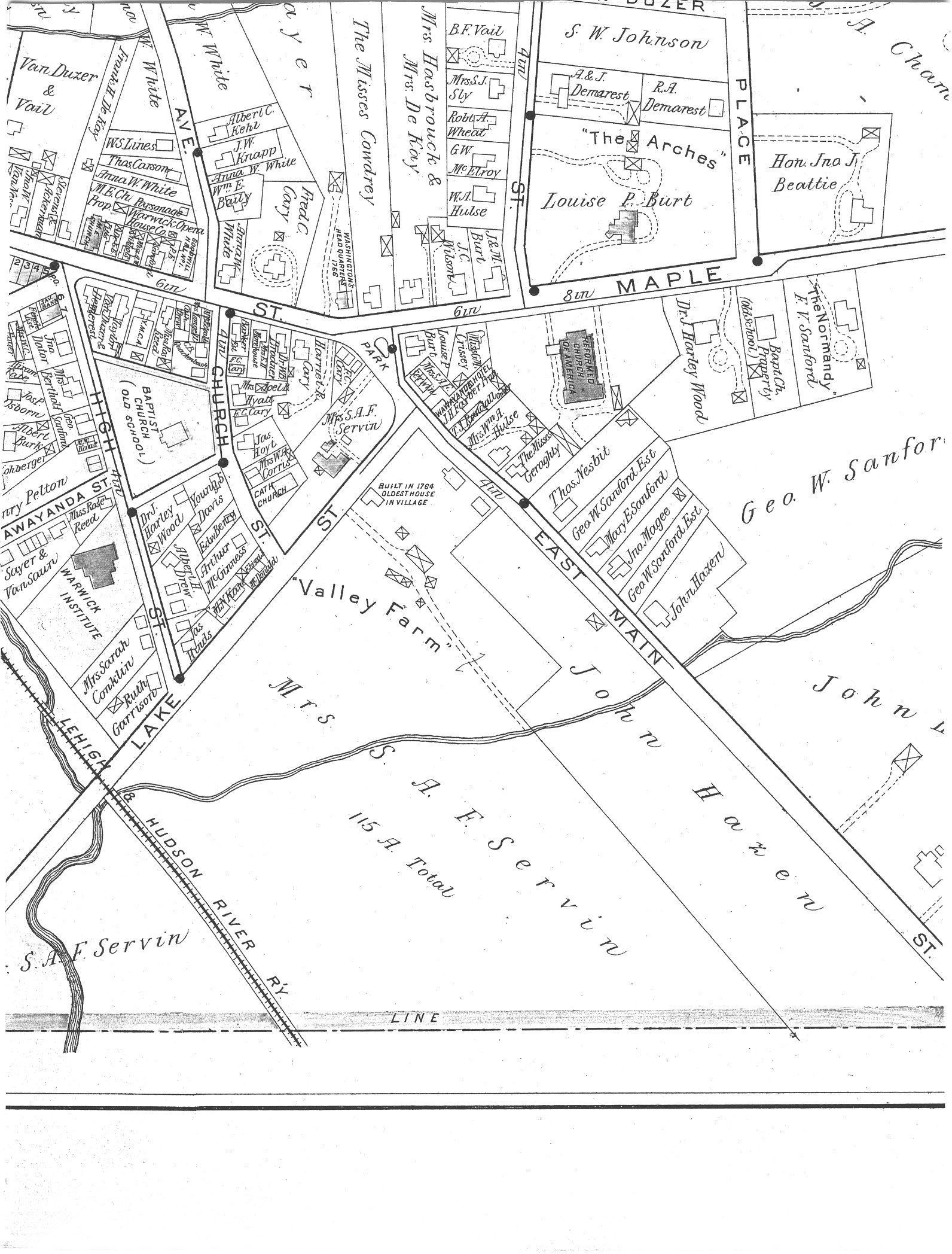
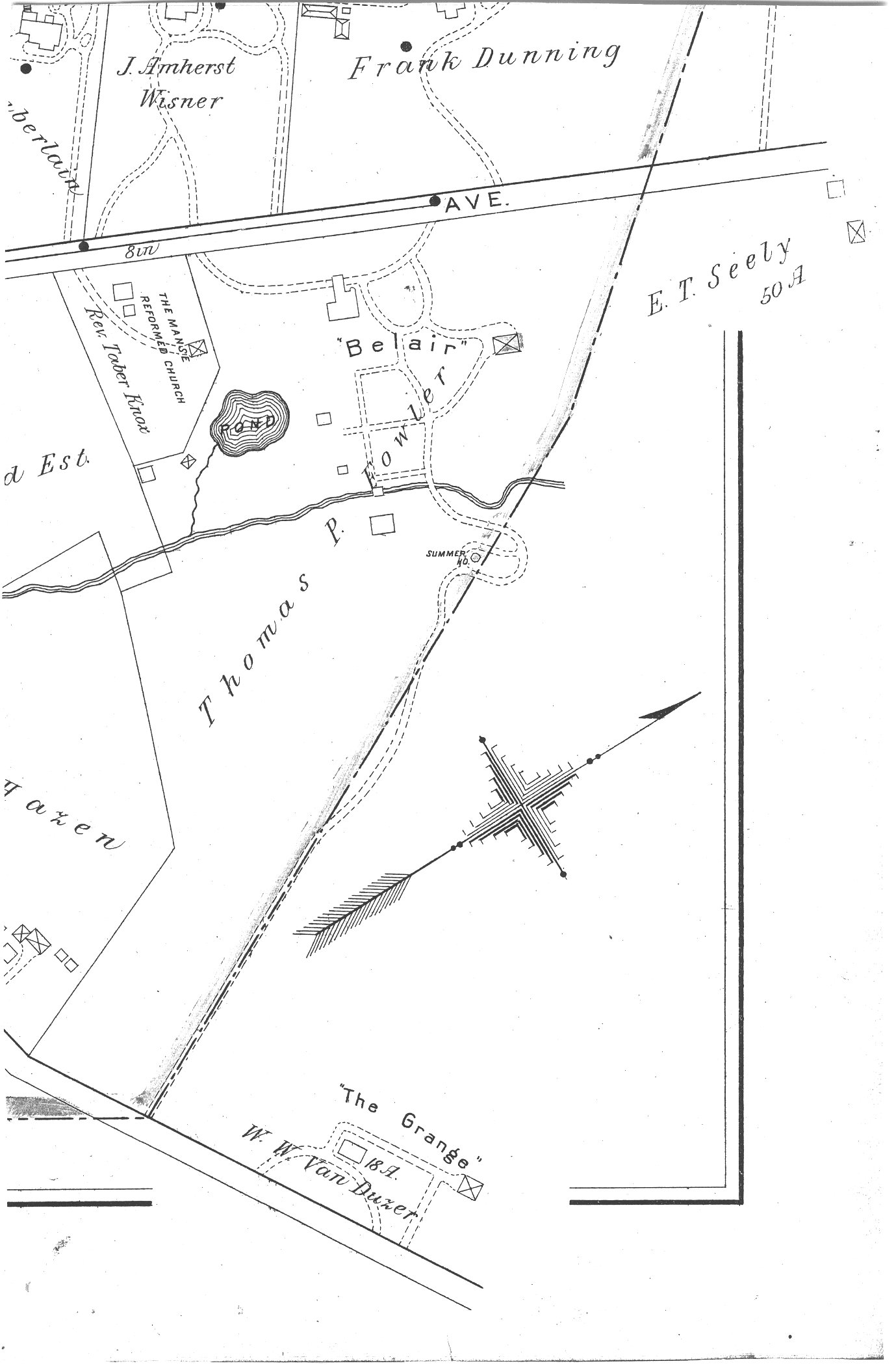
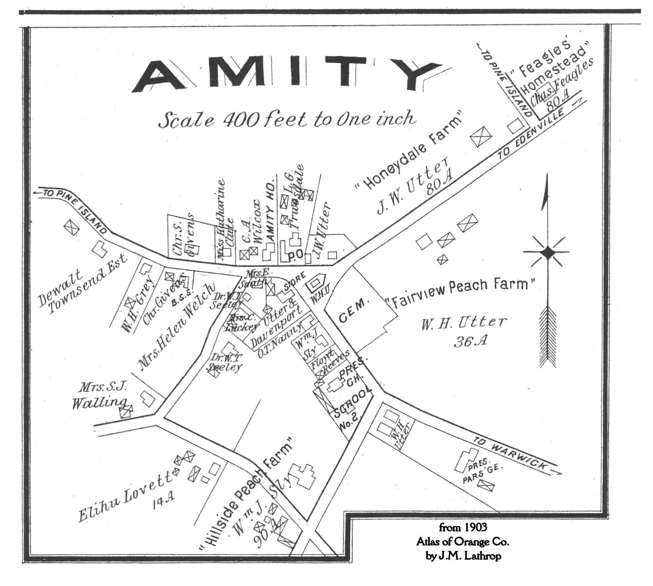
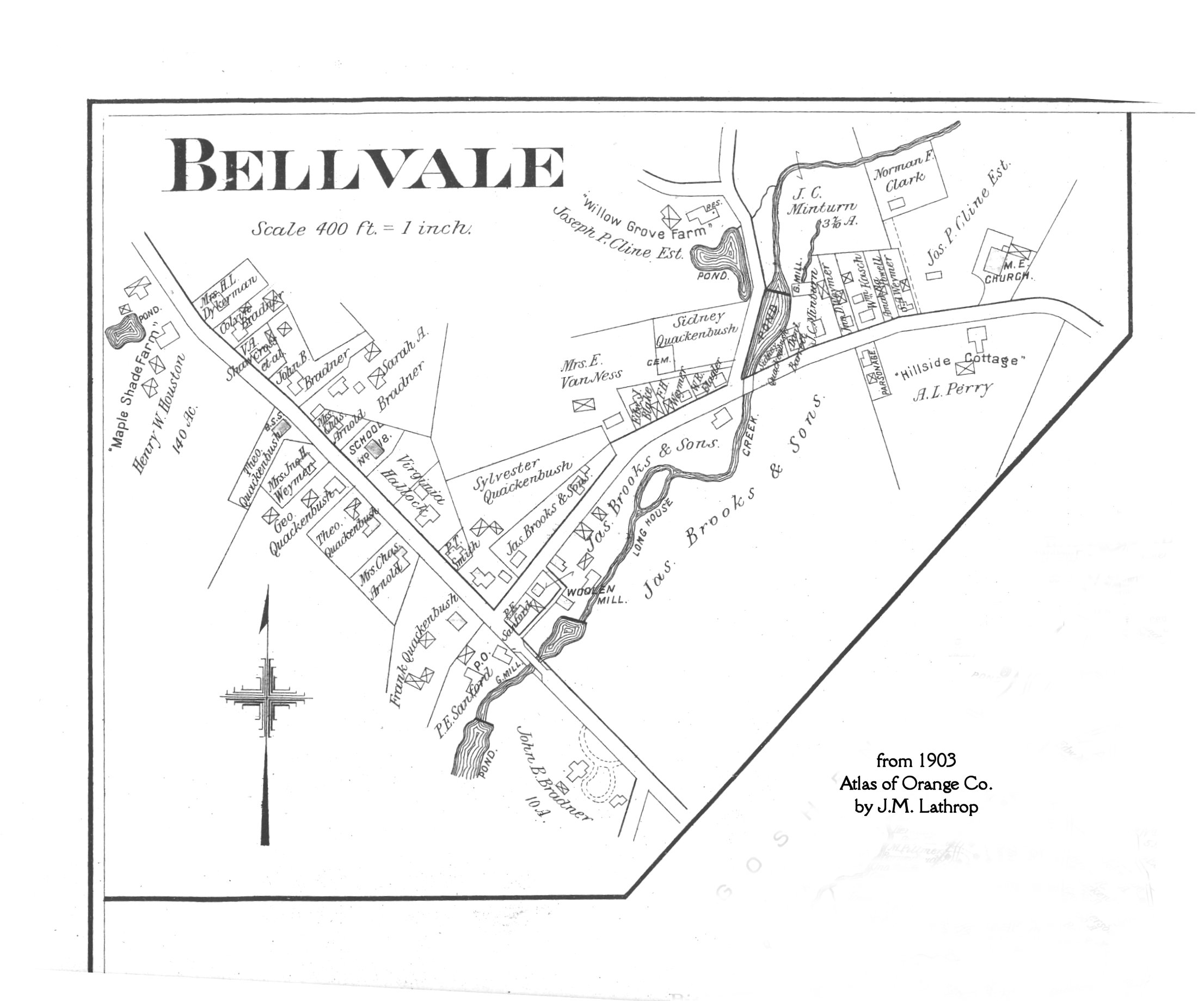
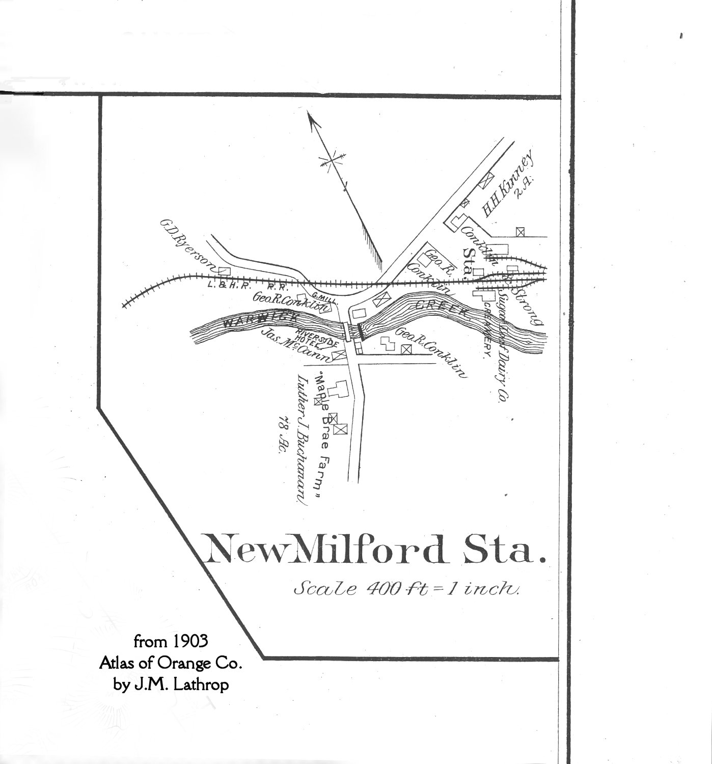
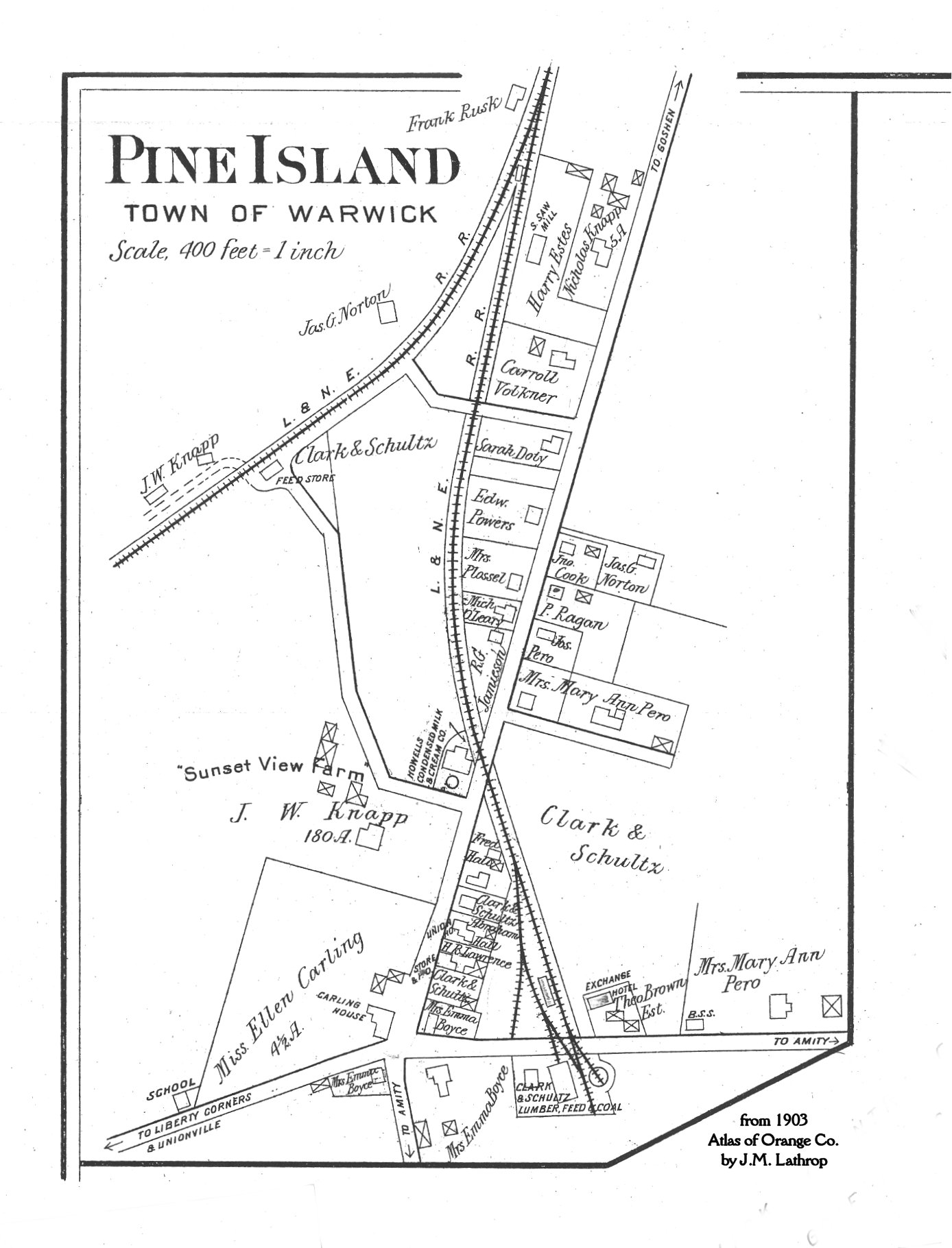
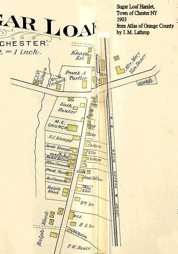
1903
|
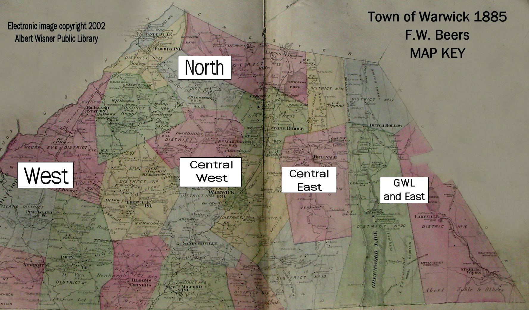
Town of Warwick & Sugar Loaf from Atlas of Orange County by J. M. Lathrop
These large maps have been split into sections the text will be legible. Use the "Key Map" to determine the section:
There is a NAME INDEX to the Village of Warwick Map showing which section of the map a name appears in.
Hamlet detail maps:
o Amity
o Bellvale
|
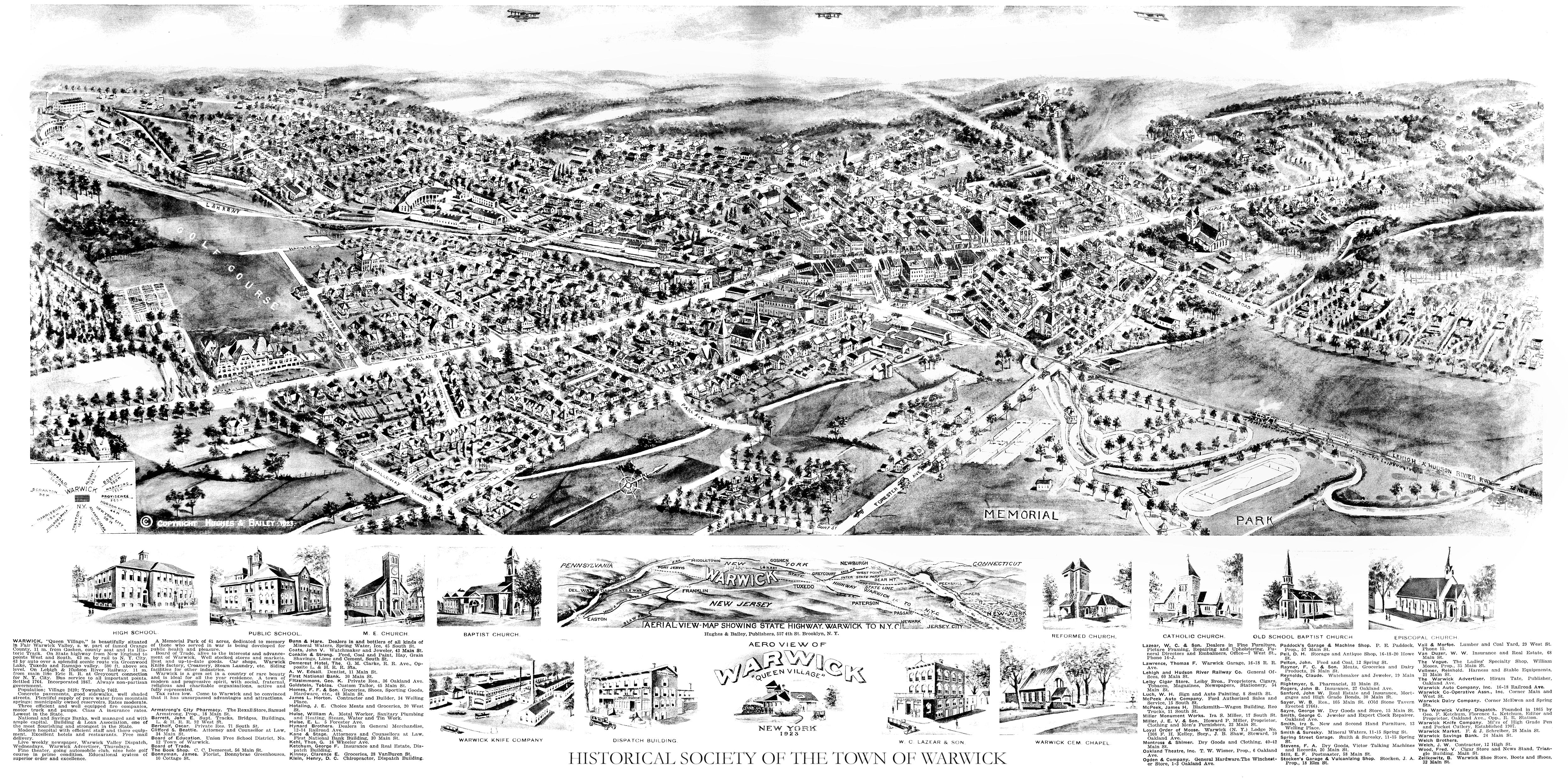
1923
|
|
1930
|
Property ownership map by Dolph & Stewart
|
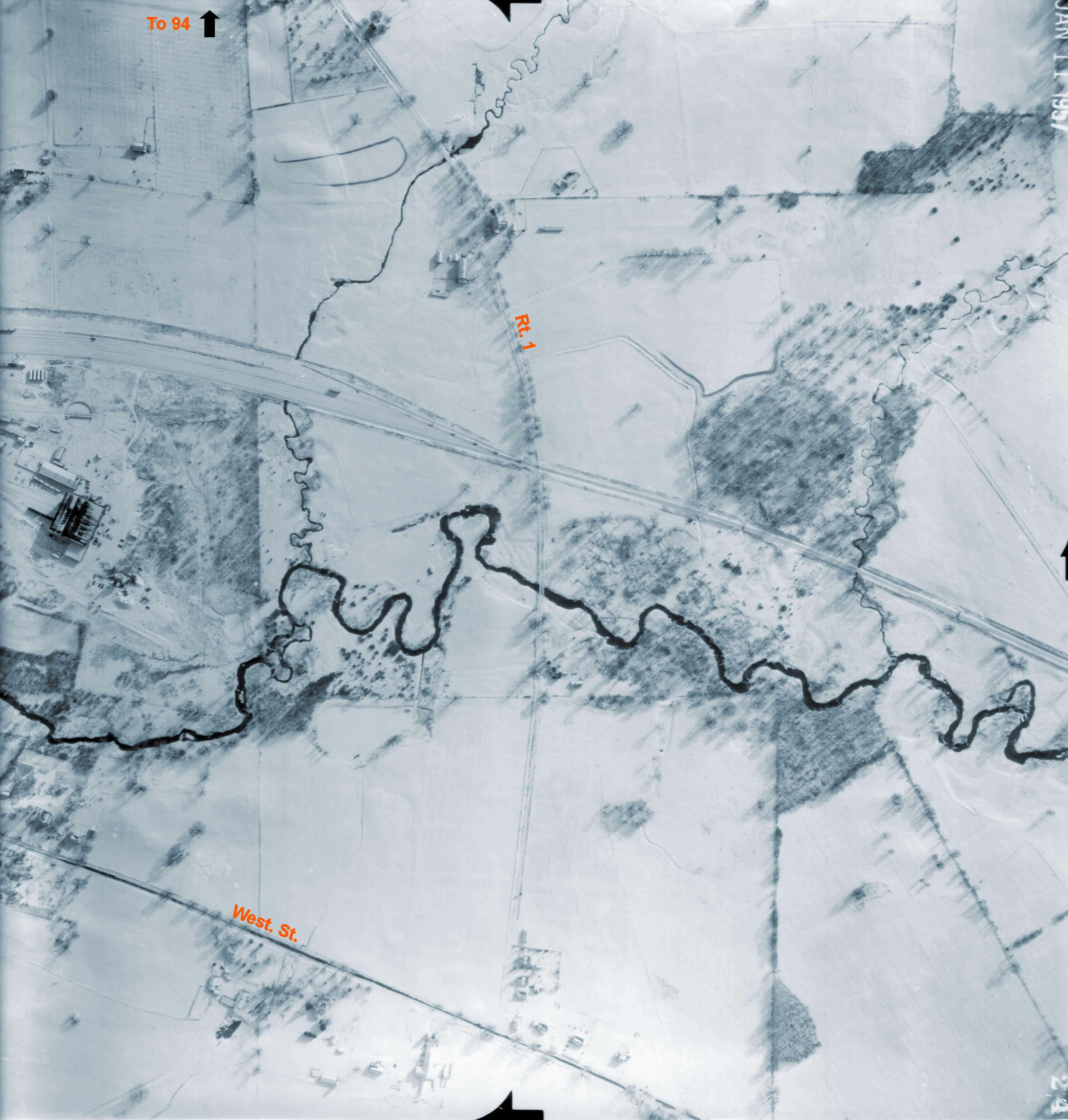
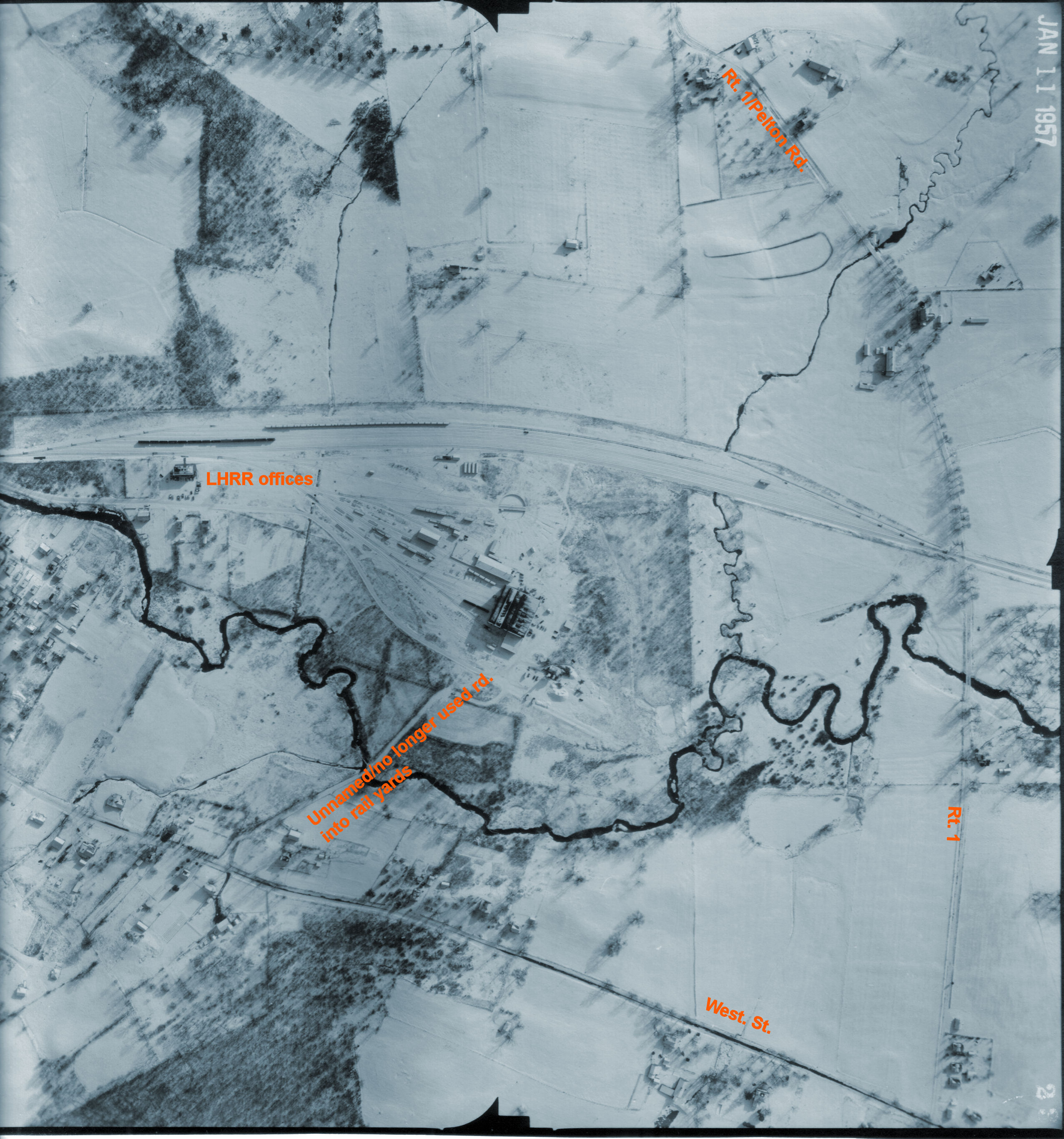
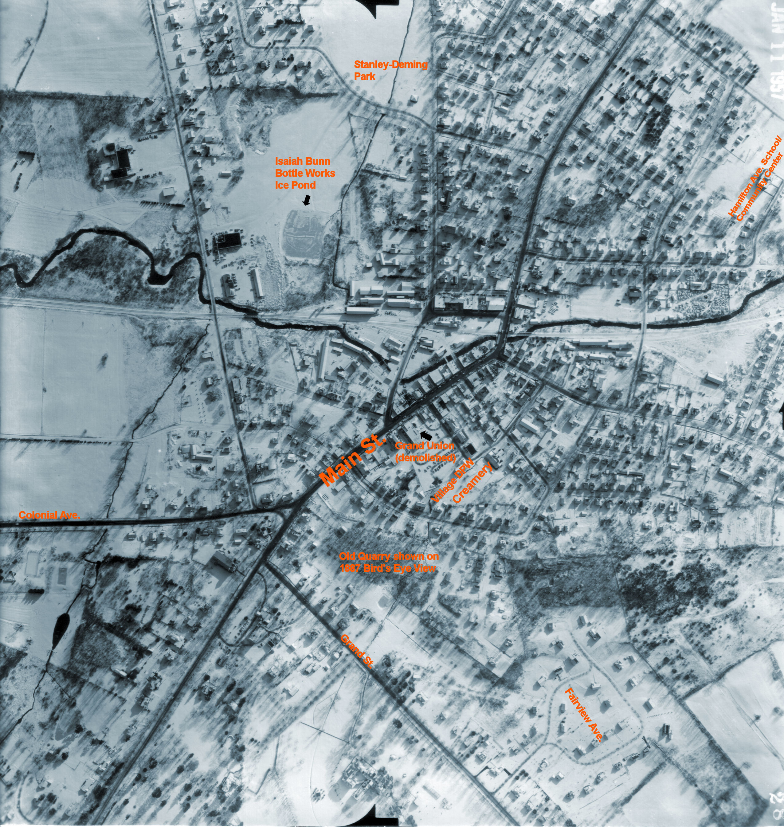
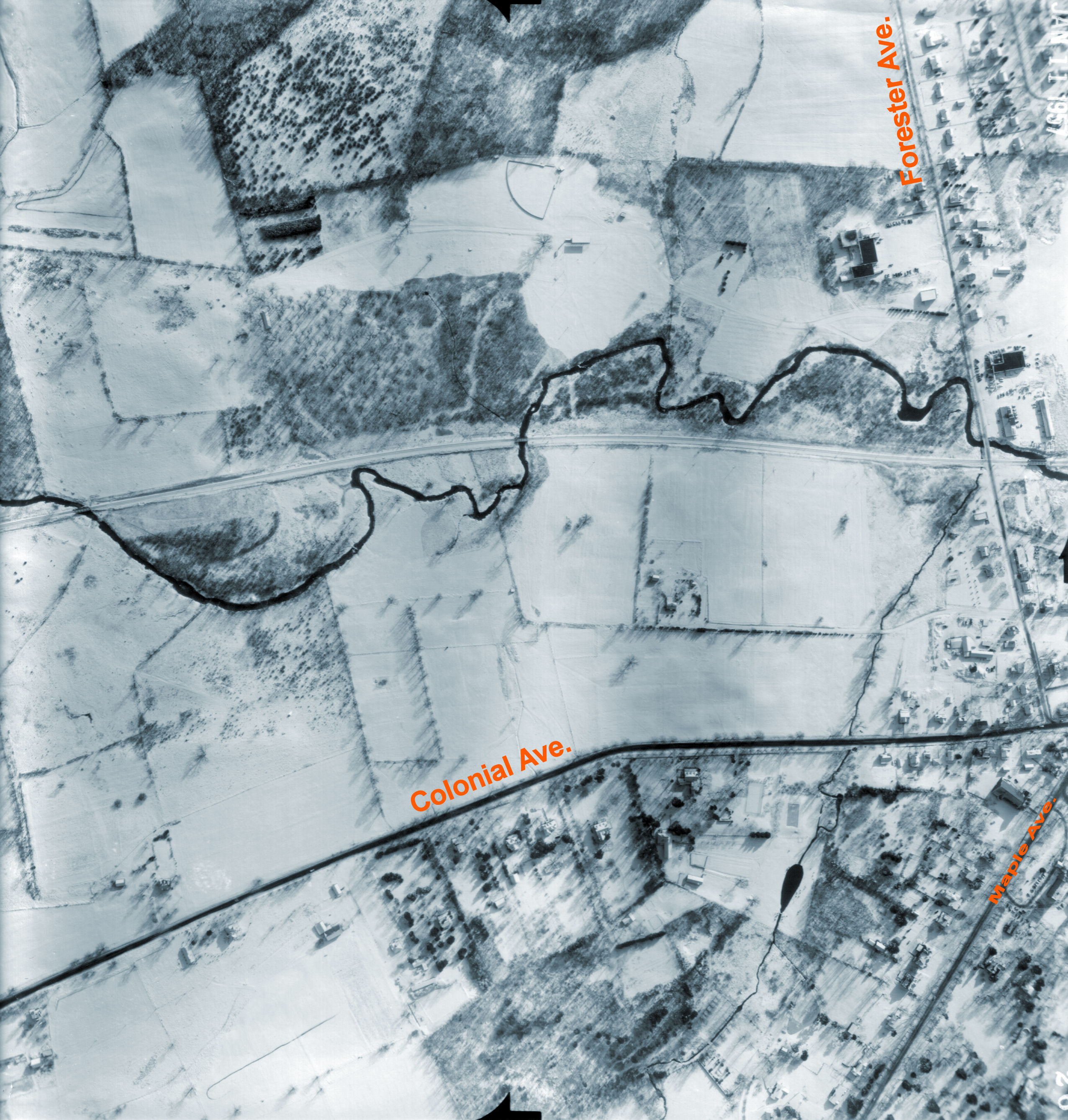
1957
|
Aerial photos of Warwick Village & railroad line
Courtesy of the Lehigh & Hudson River Railway Retiree's Assn. & Marty Felder
|
Current
|
Topographic Maps Point at various small points within "Orange County", and the names of the local quadrangle will appear. Parts of Warwick are on several
|
Current
|
Hiking Trails
|
